|
search place name
|
||
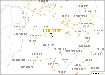
Lavistos (Cundinamarca, Colombia)Lavistos is a town in the Cundinamarca region of Colombia. An overview map of the region around Lavistos is displayed below.
regional and 3d topo map of Lavistos, Colombia ::
Lavistos airports ::
The nearest airport is BOG - Bogota Eldorado Intl, located 112.1 km south of Lavistos.
Other airports nearby include MDE - Rio Negro Jose Maria Cordova (126.1 km north west), MZL - Manizales La Nubia (139.5 km south west), EOH - Medellin Olaya Herrera (145.5 km north west), OTU - Otu (150.8 km north), Nearby towns ::
El Bosque (2.7km west) //
El Manantial (3.2km north west) //
La Miel (3.7km north west) //
Maravillas (3.9km south) //
La Palma (4.0km north west) //
Alto Frío (4.9km east) //
La Hermosa (5.0km east) //
Cascarillo (5.7km south east) //
San Isidro (5.9km east) //
Buenos Aires (5.9km west) //
Bejucales (5.9km east) //
La Cabaña (6.1km north east) //
Altamira (6.2km north east) //
La Colmena (6.4km north) //
Usache (6.6km south east) //
Ventanas (6.8km north east) //
La Primavera (7.0km north east) //
Cacagual (7.0km west) //
Dosquebradas (7.1km north east) //
Terán (7.4km north west) //
Varsovia (7.6km north) //
La Primavera (7.7km north east) //
La Reforma (7.8km north east) //
Guadualones (8.1km south) //
La Lucia (8.1km north east) //
Silencio (8.4km south) //
El Castillo (8.5km north east) //
Altomira (8.8km north) //
Patevaca (8.8km north) //
[all distances 'as the bird flies' and approximate] 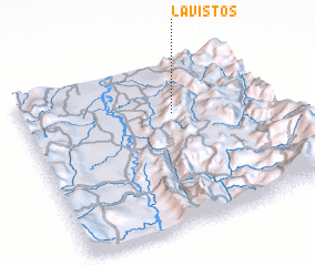 Places with similar names to Lavistos, Colombia ::
// La Vistosa (CO)
// La Vistosa (VE)
Disclaimer :: Information on this page comes without warranty of any kind |
||
|
Where is Lavistos? Elevation and coordinates ::
Latitude (lat): 5°41'9"N Longitude (lon): 74°23'24"W
Elevation (approx.): 889m (map arrows pan, magnifying glasses zoom) |
||
|
Visiting Lavistos? Hotel/Accommodation ::
Book a hotel in Lavistos Travel Guide ::
Buy a travel guide for Colombia rental cars ::
car rental offers GPS waypoint ::
download a GPX waypoint (PoI) of Lavistos for your GPS receiver
|
||