|
search place name
|
||
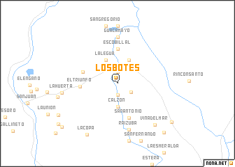
Los Botes (Santander, Colombia)Los Botes is a town in the Santander region of Colombia. An overview map of the region around Los Botes is displayed below.
regional and 3d topo map of Los Botes, Colombia ::
Los Botes airports ::
The nearest airport is EJA - Barrancabermeja Yariguies, located 66.4 km north east of Los Botes.
Other airports nearby include OTU - Otu (88.4 km north west), BGA - Bucaramanga Palonegro (122.6 km north east), MDE - Rio Negro Jose Maria Cordova (151.0 km west), EOH - Medellin Olaya Herrera (167.8 km west), Nearby towns ::
San Isidro (1.9km south) //
Buena Fortuna (1.9km south) //
Puerto Araújo (1.9km north) //
La Sonora (2.6km south east) //
Calzón (3.7km south) //
Puerto Aquileo (4.1km north east) //
La Legua (4.1km north west) //
Escobillal (5.6km north) //
San Antonio (5.9km south) //
Botón (5.9km south) //
El Águila (5.8km west) //
El Triunfo (5.9km west) //
Guacamayo (7.4km north) //
Raizuba (7.6km south) //
Viña del Mar (8.9km south east) //
La Huerta (8.9km west) //
La Copa (9.5km south west) //
La Luz (10.6km south east) //
Llano Grande (10.8km south east) //
Bellavista (11.2km south west) //
[all distances 'as the bird flies' and approximate] 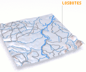 Places with similar names to Los Botes, Colombia ::
// Las Bodas (ES)
// Los Abades (ES)
// Los Beatos (ES)
// Las Botas (CO)
// Los Ceibotes (CO)
// Las Badeas (MX)
// Las Beatas (MX)
// Las Beatas (MX)
// Los Sábados (MX)
// Los Bados (HN)
Disclaimer :: Information on this page comes without warranty of any kind |
||
|
Where is Los Botes? Elevation and coordinates ::
Latitude (lat): 6°30'0"N Longitude (lon): 74°6'0"W
Elevation (approx.): 100m (map arrows pan, magnifying glasses zoom) |
||
|
Visiting Los Botes? Hotel/Accommodation ::
Book a hotel in Los Botes Travel Guide ::
Buy a travel guide for Colombia rental cars ::
car rental offers GPS waypoint ::
download a GPX waypoint (PoI) of Los Botes for your GPS receiver
|
||