|
search place name
|
||
Los Cambulos (Santander, Colombia)Los Cambulos is a town in the Santander region of Colombia. An overview map of the region around Los Cambulos is displayed below.
regional and 3d topo map of Los Cambulos, Colombia ::

Los Cambulos airports ::
The nearest airport is EJA - Barrancabermeja Yariguies, located 23.3 km north east of Los Cambulos.
Other airports nearby include BGA - Bucaramanga Palonegro (87.8 km east), OTU - Otu (88.3 km west), OCV - Ocana Aguas Claras (173.5 km north), MDE - Rio Negro Jose Maria Cordova (181.8 km south west), Nearby towns ::
La Estrellita (1.7km south) //
La Envidia (3.7km south) //
San Rafael (5.9km east) //
La Esperanza (6.4km east) //
Punta de Piedra (6.5km north east) //
La Vega (8.4km east) //
Florencia (9.0km south east) //
Las Delicias (10.4km south east) //
La Sierra (11.3km south west) //
[all distances 'as the bird flies' and approximate] 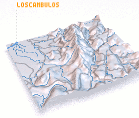 Places with similar names to Los Cambulos, Colombia ::
// Las Camelias (CO)
// Las Camelias (CO)
// Las Camelias (CO)
// Las Camelias (CO)
// Las Camelias (CO)
// Las Camelias (CO)
// Los Cámbulos (CO)
// Las Aguamilas (MX)
// Las Camelias (MX)
// Los Comales (MX)
Disclaimer :: Information on this page comes without warranty of any kind |
||
|
Where is Los Cambulos? Elevation and coordinates ::
Latitude (lat): 6°51'17"N Longitude (lon): 73°55'54"W
Elevation (approx.): 81m (map arrows pan, magnifying glasses zoom) |
||
|
Visiting Los Cambulos? Hotel/Accommodation ::
Book a hotel in Los Cambulos Travel Guide ::
Buy a travel guide for Colombia rental cars ::
car rental offers GPS waypoint ::
download a GPX waypoint (PoI) of Los Cambulos for your GPS receiver
|
||