|
search place name
|
||
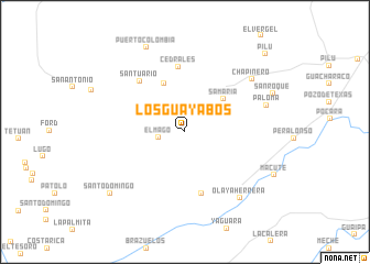
Los Guayabos (Tolima, Colombia)Los Guayabos is a town in the Tolima region of Colombia. An overview map of the region around Los Guayabos is displayed below.
regional and 3d topo map of Los Guayabos, Colombia ::
Los Guayabos airports ::
The nearest airport is IBE - Ibague Perales, located 66.6 km north east of Los Guayabos.
Other airports nearby include AXM - Armenia El Eden (77.1 km north west), ULQ - Tulua Farfan (97.8 km west), NVA - Neiva Benito Salas (102.5 km south), PEI - Pereira Matecana (111.3 km north), Nearby towns ::
El Mago (2.7km west) //
Samaría (5.1km north east) //
El Corazón (5.3km north west) //
Chipalo (6.4km south) //
Cedrales (6.6km north) //
Santuario (6.9km north west) //
Chapinero (8.6km north east) //
Olaya Herrera (8.7km south east) //
Paloma (8.7km east) //
Puerto Colombia (9.4km north west) //
San Roque (9.7km north east) //
Santo Domingo (9.8km south west) //
Pilú (11.4km north east) //
[all distances 'as the bird flies' and approximate] 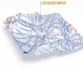 Places with similar names to Los Guayabos, Colombia ::
// Los Guayabos (PA)
// Los Guayabos (CO)
// Los Guayabos (CO)
// Los Guayabos (CO)
// Los Guayabos (CO)
// Las Guayabas (SV)
// Las Guayabas (GT)
// Las Guayabas (MX)
// Las Guayabas (MX)
// Los Guayabos (MX)
Disclaimer :: Information on this page comes without warranty of any kind |
||
|
Where is Los Guayabos? Elevation and coordinates ::
Latitude (lat): 3°52'22"N Longitude (lon): 75°22'53"W
Elevation (approx.): 1344m (map arrows pan, magnifying glasses zoom) |
||
|
Visiting Los Guayabos? Hotel/Accommodation ::
Book a hotel in Los Guayabos Travel Guide ::
Buy a travel guide for Colombia rental cars ::
car rental offers GPS waypoint ::
download a GPX waypoint (PoI) of Los Guayabos for your GPS receiver
|
||