|
search place name
|
||
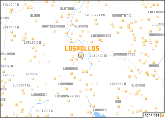
Los Pollos (Antioquia, Colombia)Los Pollos is a town in the Antioquia region of Colombia. An overview map of the region around Los Pollos is displayed below.
regional and 3d topo map of Los Pollos, Colombia ::
Los Pollos airports ::
The nearest airport is EOH - Medellin Olaya Herrera, located 70.3 km south of Los Pollos.
Other airports nearby include MDE - Rio Negro Jose Maria Cordova (80.4 km south), OTU - Otu (106.0 km east), UIB - Quibdo El Carano (168.1 km south west), MZL - Manizales La Nubia (202.7 km south), Nearby towns ::
El Otro Lado (1.4km west) //
La María (2.1km south east) //
Mangagrande (2.3km west) //
Bellavista (2.4km south west) //
San José de La Montaña (2.5km west) //
Los Duendes (2.7km north west) //
La Merced (2.7km north) //
El Zancudo (2.8km south) //
Camburé (2.9km north west) //
El Cuchillón (3.0km south) //
San Pablo (3.1km north west) //
El Cedral (3.7km north west) //
Altamaria (3.7km east) //
Castillo (3.8km north east) //
La Convención (3.8km north east) //
Potrerito (4.1km south east) //
La Persía (4.1km south west) //
Esperana Lopera (4.3km south west) //
El Castillo (4.3km north east) //
La Mocha Roldán (4.4km north east) //
Yarumal (4.4km north) //
La Esperanza (4.6km south west) //
Santa Ines (4.7km north west) //
La Ilusión (4.8km south) //
El Hueco (5.3km north) //
Rio Abajo (5.3km north west) //
Vega del Río (5.8km south) //
Cruces (5.8km north east) //
La Chorrera (6.0km north east) //
[all distances 'as the bird flies' and approximate] 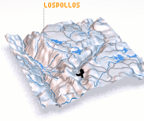 Places with similar names to Los Pollos, Colombia ::
// Las Pailas (CU)
// Las Palas (ES)
// Laspaúles (ES)
// Las Pilas (ES)
// Las Pullas (ES)
// Lacy Place (US)
// Los Palos (CL)
// Las Pailas (CO)
// Las Pailas (CO)
// Las Pailas (CO)
Disclaimer :: Information on this page comes without warranty of any kind |
||
|
Where is Los Pollos? Elevation and coordinates ::
Latitude (lat): 6°51'7"N Longitude (lon): 75°39'40"W
Elevation (approx.): 2782m (map arrows pan, magnifying glasses zoom) |
||
|
Visiting Los Pollos? Hotel/Accommodation ::
Book a hotel in Los Pollos Travel Guide ::
Buy a travel guide for Colombia rental cars ::
car rental offers GPS waypoint ::
download a GPX waypoint (PoI) of Los Pollos for your GPS receiver
|
||