|
search place name
|
||
Payandé (Cundinamarca, Colombia)Payandé is a town in the Cundinamarca region of Colombia. An overview map of the region around Payandé is displayed below.
regional and 3d topo map of Payandé, Colombia ::

Payandé airports ::
The nearest airport is BOG - Bogota Eldorado Intl, located 50.0 km south east of Payandé.
Other airports nearby include IBE - Ibague Perales (93.8 km south west), MZL - Manizales La Nubia (107.1 km west), VVC - Villavicencio Vanguardia (133.4 km south east), PEI - Pereira Matecana (138.8 km west), Nearby towns ::
Bagazal (1.8km east) //
Santa Isabel (1.8km west) //
Barranquilla (2.6km south west) //
San Miguel (3.7km south) //
Buenos Aires (4.1km south west) //
Villeta (4.5km north east) //
Bucaramanga (5.5km west) //
San Pedro (5.6km north) //
San Mateo (5.6km north) //
San Cayetano (5.8km west) //
La Concepción (5.8km west) //
La Granja (5.8km west) //
El Limón (5.9km south) //
El Hato (6.7km south west) //
San José (6.7km south west) //
El Zarcillo (6.7km north west) //
Cune (7.4km north) //
Providencia (7.6km south) //
Pensilvania (7.6km west) //
La Cabaña (7.8km north west) //
El Boquerón (7.8km north west) //
Santa Catalina (8.3km south east) //
Chimbe (8.3km south east) //
San Isidro (8.3km north west) //
Potosí (9.2km north west) //
Taboga (9.2km south east) //
[all distances 'as the bird flies' and approximate] 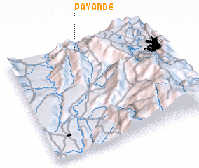 Places with similar names to Payandé, Colombia ::
Disclaimer :: Information on this page comes without warranty of any kind |
||
|
Where is Payandé? Elevation and coordinates ::
Latitude (lat): 4°59'0"N Longitude (lon): 74°30'0"W
Elevation (approx.): 929m (map arrows pan, magnifying glasses zoom) |
||
|
Visiting Payandé? Hotel/Accommodation ::
Book a hotel in Payandé Travel Guide ::
Buy a travel guide for Colombia rental cars ::
car rental offers GPS waypoint ::
download a GPX waypoint (PoI) of Payandé for your GPS receiver
|
||