|
search place name
|
||
Piñalito (Bolívar, Colombia)Piñalito is a town in the Bolívar region of Colombia. An overview map of the region around Piñalito is displayed below.
regional and 3d topo map of Piñalito, Colombia ::

Piñalito airports ::
The nearest airport is MGN - Magangue Baracoa, located 17.7 km north of Piñalito.
Other airports nearby include CZU - Corozal Las Brujas (58.6 km west), MTR - Monteria Los Garzones (118.9 km west), CTG - Cartagena Rafael Nunez (164.9 km north west), OCV - Ocana Aguas Claras (181.8 km south east), Nearby towns ::
Tacasaluma (3.2km south) //
La Estrella (3.8km west) //
San Antoñito (4.3km west) //
Guayacán (4.5km east) //
San Gabriel (4.7km west) //
Barahona (4.9km west) //
Santa Fé (5.2km north east) //
Cáceres (5.3km north west) //
La Estación (5.5km north west) //
Guazo (7.2km north east) //
Planta del Coco (7.6km east) //
Retiro (7.7km north east) //
Bravo (8.1km north west) //
Barranca (8.1km north west) //
Madrid (8.4km north east) //
San Pablo (8.7km north) //
San Francisco de Loba (9.8km north east) //
San Pablo (10.4km north west) //
[all distances 'as the bird flies' and approximate] 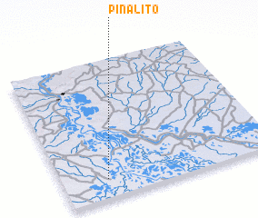 Places with similar names to Piñalito, Colombia ::
// Panhla Te (MM)
// Penna Alta (IT)
// Pianelleto (IT)
// Pinalito (CU)
// Peñolite (ES)
// Piñalito (CO)
// Piñalito (CO)
// Piñalito (CO)
// Piñalito (CO)
// Piñalito (CO)
Disclaimer :: Information on this page comes without warranty of any kind |
||
|
Where is Piñalito? Elevation and coordinates ::
Latitude (lat): 9°8'5"N Longitude (lon): 74°47'27"W
Elevation (approx.): 13m (map arrows pan, magnifying glasses zoom) |
||
|
Visiting Piñalito? Hotel/Accommodation ::
Book a hotel in Piñalito Travel Guide ::
Buy a travel guide for Colombia rental cars ::
car rental offers GPS waypoint ::
download a GPX waypoint (PoI) of Piñalito for your GPS receiver
|
||