|
search place name
|
||
Piscinita (Providencia y Santa Catalina, Departamento de Archipiélago de San Andrés, Colombia)Piscinita is a town in the Providencia y Santa Catalina, Departamento de Archipiélago de San Andrés region of Colombia. An overview map of the region around Piscinita is displayed below.
regional and 3d topo map of Piscinita, Colombia ::
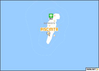
Piscinita airports ::
The nearest airport is ADZ - San Andres Island Gustavo Rojas Pinilla, located 7.4 km north of Piscinita.
Other airports nearby include PVA - Providencia El Embrujo (100.8 km north east), PUZ - Puerto Cabezas (247.8 km north west), Nearby towns ::
El Cove (0.0km north) //
Cueva de Morgan (1.9km north) //
San Francisco (1.8km east) //
San Luis (2.6km north east) //
Alto Harmony Hall (3.7km north) //
Buenavista (3.7km north) //
La Loma (5.8km north) //
San Andrés (7.8km north) //
[all distances 'as the bird flies' and approximate]  Places with similar names to Piscinita, Colombia ::
Disclaimer :: Information on this page comes without warranty of any kind |
||
|
Where is Piscinita? Elevation and coordinates ::
Latitude (lat): 12°31'0"N Longitude (lon): 81°43'0"W
Elevation (approx.): 5m (map arrows pan, magnifying glasses zoom) |
||
|
Visiting Piscinita? Hotel/Accommodation ::
Book a hotel in Piscinita Travel Guide ::
Buy a travel guide for Colombia rental cars ::
car rental offers GPS waypoint ::
download a GPX waypoint (PoI) of Piscinita for your GPS receiver
|
||