|
search place name
|
||
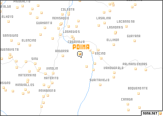
Poima (Santander, Colombia)Poima is a town in the Santander region of Colombia. An overview map of the region around Poima is displayed below.
regional and 3d topo map of Poima, Colombia ::
Poima airports ::
The nearest airport is BGA - Bucaramanga Palonegro, located 109.4 km north of Poima.
Other airports nearby include EJA - Barrancabermeja Yariguies (122.7 km north west), TME - Tame (156.4 km east), BOG - Bogota Eldorado Intl (194.3 km south west), OTU - Otu (199.3 km north west), Nearby towns ::
Chapa (2.3km south east) //
Anacal (2.4km north west) //
El Llano (2.7km north east) //
Casa Vieja (2.8km north) //
Quebrada Amoladero (2.9km north east) //
Rionegro (3.3km south east) //
San Rafael (3.8km south east) //
El Delirio (4.2km north east) //
Andorra (4.3km west) //
Encino (4.5km east) //
Carrillo (4.9km north) //
Los Medios (5.4km north west) //
Cachipay (7.3km north west) //
Virolín (7.4km south west) //
San Cayetano (7.4km north) //
Suaita Viejo (7.5km south east) //
El Olvido (7.9km north) //
La Esperanza (8.0km north west) //
El Limón (8.0km east) //
Vaho de Palo (8.2km south east) //
Arbolsolo (8.5km north east) //
Guacamayas (8.6km north) //
Campo Hermoso (8.7km north west) //
San Agustín (8.7km south east) //
Materito (8.9km south west) //
El Tesoro (9.0km south west) //
La Vega (9.2km north west) //
Nemisaque (9.3km north west) //
Santa Clara (9.6km north east) //
[all distances 'as the bird flies' and approximate]  Places with similar names to Poima, Colombia ::
Disclaimer :: Information on this page comes without warranty of any kind |
||
|
Where is Poima? Elevation and coordinates ::
Latitude (lat): 6°8'19"N Longitude (lon): 73°8'19"W
Elevation (approx.): 1846m (map arrows pan, magnifying glasses zoom) |
||
|
Visiting Poima? Hotel/Accommodation ::
Book a hotel in Poima Travel Guide ::
Buy a travel guide for Colombia rental cars ::
car rental offers GPS waypoint ::
download a GPX waypoint (PoI) of Poima for your GPS receiver
|
||