|
search place name
|
||
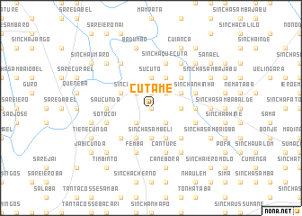
Cutame (Guinea-Bissau)Cutame is a town in Guinea-Bissau. An overview map of the region around Cutame is displayed below.
regional and 3d topo map of Cutame, Guinea-Bissau ::
Cutame airports ::
The nearest airport is BXO - Bissau Oswaldo Vieira Intl, located 137.7 km west of Cutame.
Other airports nearby include TUD - Tambacounda (176.3 km north east), ZIG - Ziguinchor (196.6 km west), KLC - Kaolack (260.1 km north west), Nearby towns ::
Sinchã Braíma (0.0km north) //
Sinchã Saliu (1.9km north) //
Gadaboma (1.9km north) //
Campate (2.6km north east) //
Sinchã Sucuta (2.6km north west) //
Sinchã Quecuta (2.6km north west) //
Sinchã Laibe (2.6km north west) //
Sabuiacunda (2.6km south east) //
Sinchã Modè Uri (2.6km north west) //
Sinchã Bácari (2.6km south west) //
Camandé (3.6km east) //
Sinchã Ióbà (3.6km east) //
Sucutó (3.7km north) //
Querelento (3.7km north) //
Sonaco (3.7km north) //
Áfià (3.7km north) //
Jaimanto (3.7km north) //
Sinchã Sambeli (3.7km south) //
Madina Samba (4.1km north east) //
Sinchã Canho (4.1km north east) //
Sinchã Samba Jau (4.1km north east) //
Ongã (4.1km north west) //
Fula Mori (4.1km north west) //
Sinchã Samba (4.1km south east) //
Cunji (4.1km south west) //
Sinchã Nhaco (4.1km south west) //
Sibijá (4.1km south west) //
Nhantida (5.2km north east) //
Patassa (5.2km south east) //
[all distances 'as the bird flies' and approximate] 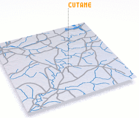 Places with similar names to Cutame, Guinea-Bissau ::
Disclaimer :: Information on this page comes without warranty of any kind |
||
|
Where is Cutame? Elevation and coordinates ::
Latitude (lat): 12°22'0"N Longitude (lon): 14°29'0"W
Elevation (approx.): 48m (map arrows pan, magnifying glasses zoom) |
||
|
Visiting Cutame? Hotel/Accommodation ::
Book a hotel in Cutame Travel Guide ::
rental cars ::
car rental offers GPS waypoint ::
download a GPX waypoint (PoI) of Cutame for your GPS receiver
|
||