|
search place name
|
||
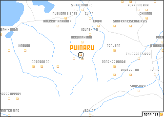
Puinaru (La Guajira, Colombia)Puinaru is a town in the La Guajira region of Colombia. An overview map of the region around Puinaru is displayed below.
regional and 3d topo map of Puinaru, Colombia ::
Puinaru airports ::
The nearest airport is RCH - Rio Hacha Almirante Padilla, located 164.5 km south west of Puinaru.
Other airports nearby include LSP - Paraguana Josefa Camejo (168.4 km east), AUA - Oranjestad Reina Beatrix Intl (176.1 km east), MAR - Maracaibo La Chinita Intl (189.4 km south), CZE - Coro Jose Leonardo Chirinos (230.9 km south east), Nearby towns ::
Karraisira (0.0km north) //
Taureche (1.8km west) //
Urruimahana (3.7km north) //
Kayútsahin (5.7km west) //
Mouáshira (5.8km north) //
Poruena (7.5km east) //
Jaypárehin (7.5km east) //
Rancho Grande (7.5km east) //
Epipa (8.3km north east) //
Kalaraumaha (8.1km south east) //
Anerrutamahana (9.2km north west) //
Mahú (10.4km north east) //
[all distances 'as the bird flies' and approximate] 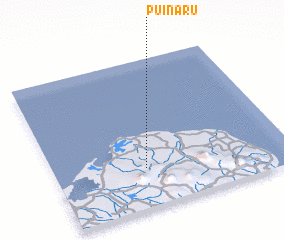 Places with similar names to Puinaru, Colombia ::
Disclaimer :: Information on this page comes without warranty of any kind |
||
|
Where is Puinaru? Elevation and coordinates ::
Latitude (lat): 12°16'0"N Longitude (lon): 71°37'0"W
Elevation (approx.): 102m (map arrows pan, magnifying glasses zoom) |
||
|
Visiting Puinaru? Hotel/Accommodation ::
Book a hotel in Puinaru Travel Guide ::
Buy a travel guide for Colombia rental cars ::
car rental offers GPS waypoint ::
download a GPX waypoint (PoI) of Puinaru for your GPS receiver
|
||