|
search place name
|
||
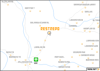
Restrepo (Meta, Colombia)Restrepo is a town in the Meta region of Colombia. An overview map of the region around Restrepo is displayed below.
regional and 3d topo map of Restrepo, Colombia ::
Restrepo airports ::
The nearest airport is VVC - Villavicencio Vanguardia, located 10.5 km south west of Restrepo.
Other airports nearby include BOG - Bogota Eldorado Intl (81.5 km north west), IBE - Ibague Perales (174.9 km west), SJE - San Jose Del Guaviare Jorge E Gonzalez Torres (211.5 km south east), MZL - Manizales La Nubia (227.6 km west), Nearby towns ::
El Cortijo (2.6km south west) //
Salinas de Cumaral (5.2km north west) //
La Palmera (6.7km south west) //
La Palma (11.5km south east) //
[all distances 'as the bird flies' and approximate] 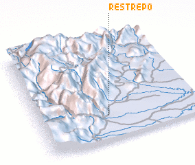 Places with similar names to Restrepo, Colombia ::
Disclaimer :: Information on this page comes without warranty of any kind |
||
|
Where is Restrepo? Elevation and coordinates ::
Latitude (lat): 4°15'0"N Longitude (lon): 73°34'0"W
Elevation (approx.): 478m (map arrows pan, magnifying glasses zoom) |
||
|
Visiting Restrepo? Hotel/Accommodation ::
Book a hotel in Restrepo Travel Guide ::
Buy a travel guide for Colombia rental cars ::
car rental offers GPS waypoint ::
download a GPX waypoint (PoI) of Restrepo for your GPS receiver
|
||