|
search place name
|
||
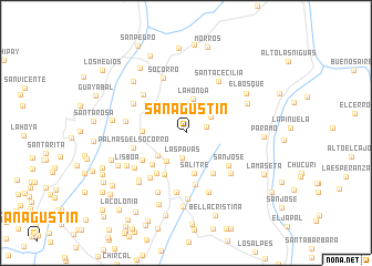
San Agustín (Santander, Colombia)San Agustín is a town in the Santander region of Colombia. An overview map of the region around San Agustín is displayed below.
regional and 3d topo map of San Agustín, Colombia ::
San Agustín airports ::
The nearest airport is BGA - Bucaramanga Palonegro, located 78.3 km north of San Agustín.
Other airports nearby include EJA - Barrancabermeja Yariguies (91.5 km north west), TME - Tame (163.9 km east), OTU - Otu (175.6 km west), SVZ - San Antonio Del Tachira (180.3 km north east), Nearby towns ::
Árbol Solo (2.2km east) //
Las Pavas (2.6km south) //
La Laguna (2.8km north east) //
Hora de San José (3.0km north east) //
Aguabuena (3.5km south west) //
La Honda (3.5km north) //
Altamira (3.6km south west) //
Salitre (4.2km south) //
Villa Gómez (4.4km west) //
Sevilla (4.7km south west) //
Los Comuneros (4.7km south west) //
La Esperanza (4.9km south east) //
El Liestal (5.0km south west) //
Casa Nueva (5.1km south west) //
San Rafael (5.3km south) //
San José (5.3km south east) //
Palmas del Socorro (5.4km west) //
Villa Rosa (5.7km north west) //
El Limón (5.8km south west) //
Socorro (5.9km north) //
La Victoria (6.0km south) //
Barlovento (6.0km north west) //
Santa Cecilia (6.1km north east) //
San Clemente (6.1km south east) //
La Plazuela (6.2km west) //
Versalles (6.2km south west) //
San Francisco (6.4km south) //
Ensillada (6.6km south west) //
Confines (6.6km south) //
[all distances 'as the bird flies' and approximate]  Places with similar names to San Agustín, Colombia ::
// San Agustin (US)
// San Augustine (US)
// San Agustín (PA)
// San Agustín (PA)
// San Agustín (CU)
// San Agustín (CU)
// San Agustín (CU)
// San Agustín (CU)
// San Agustín (CU)
// San Agustín (CU)
Disclaimer :: Information on this page comes without warranty of any kind |
||
|
Where is San Agustín? Elevation and coordinates ::
Latitude (lat): 6°25'13"N Longitude (lon): 73°14'28"W
Elevation (approx.): 1573m (map arrows pan, magnifying glasses zoom) |
||
|
Visiting San Agustín? Hotel/Accommodation ::
Book a hotel in San Agustín Travel Guide ::
Buy a travel guide for Colombia rental cars ::
car rental offers GPS waypoint ::
download a GPX waypoint (PoI) of San Agustín for your GPS receiver
|
||