|
search place name
|
||
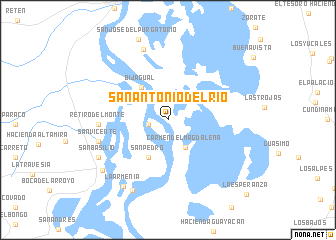
San Antonio del Río (Magdalena, Colombia)San Antonio del Río is a town in the Magdalena region of Colombia. An overview map of the region around San Antonio del Río is displayed below.
regional and 3d topo map of San Antonio del Río, Colombia ::
San Antonio del Río airports ::
The nearest airport is MGN - Magangue Baracoa, located 40.1 km south of San Antonio del Río.
Other airports nearby include CZU - Corozal Las Brujas (66.5 km south west), CTG - Cartagena Rafael Nunez (121.1 km north west), BAQ - Barranquilla Ernesto Cortissoz (138.5 km north), MTR - Monteria Los Garzones (147.4 km south west), Nearby towns ::
San Roque (2.2km west) //
Córdoba (2.2km west) //
Carmen del Magdalena (3.6km south east) //
Bijagual (4.7km north west) //
San Pedro (4.7km south west) //
Retiro del Monte (7.6km west) //
San Vicente (8.0km west) //
Cuatro Vientos (8.4km north) //
San Basilio (8.7km south west) //
Pensilvania (8.8km south west) //
La Armenia (8.9km south west) //
Córdoba (9.1km south west) //
La Esperanza (11.9km south east) //
[all distances 'as the bird flies' and approximate]  Places with similar names to San Antonio del Río, Colombia ::
// San Antonio del Río (MX)
// San Antonio del Río (MX)
// San Antonio del Río (MX)
// San Antonio del Río (MX)
// San Antonio del Río (MX)
Disclaimer :: Information on this page comes without warranty of any kind |
||
|
Where is San Antonio del Río? Elevation and coordinates ::
Latitude (lat): 9°38'16"N Longitude (lon): 74°45'50"W
Elevation (approx.): 16m (map arrows pan, magnifying glasses zoom) |
||
|
Visiting San Antonio del Río? Hotel/Accommodation ::
Book a hotel in San Antonio del Río Travel Guide ::
Buy a travel guide for Colombia rental cars ::
car rental offers GPS waypoint ::
download a GPX waypoint (PoI) of San Antonio del Río for your GPS receiver
|
||