|
search place name
|
||
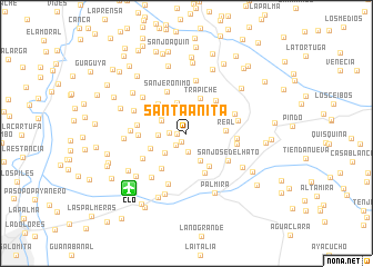
Santa Anita (Valle del Cauca, Colombia)Santa Anita is a town in the Valle del Cauca region of Colombia. An overview map of the region around Santa Anita is displayed below.
regional and 3d topo map of Santa Anita, Colombia ::
Santa Anita airports ::
The nearest airport is CLO - Cali Alfonso Bonilla Aragon Intl, located 8.0 km south west of Santa Anita.
Other airports nearby include ULQ - Tulua Farfan (55.7 km north), BUN - Buenaventura Gerardo Tobar Lopez (77.5 km west), AXM - Armenia El Eden (113.8 km north east), PPN - Popayan Guillermo Leon Valencia (129.7 km south), Nearby towns ::
Casangal (0.9km west) //
Mi Ranchito (1.0km south west) //
Ermita (1.6km south west) //
Florinda (1.8km west) //
Malibú (1.9km south) //
Olga (2.8km north west) //
Olga (2.8km north west) //
Pozo Verde (2.8km west) //
Cantalamota (2.9km south west) //
Cascajal (3.1km south east) //
El Viaducto (3.2km north) //
Trapiche (3.8km north) //
Florencia (3.9km west) //
La Lomita (4.0km south east) //
Real (4.0km east) //
Finalfa (4.1km north west) //
Bella Vista (4.3km south west) //
Coronado (4.4km south east) //
Chontaduro Terronal (4.5km north east) //
San Jerónimo (4.7km north west) //
El Abrujal (4.9km west) //
San José del Hato (5.0km south east) //
Bizarro (5.1km south west) //
La Soledad (5.1km west) //
La Gertrudis (5.1km east) //
La Manuelita (5.2km east) //
Samaria (5.3km east) //
El Hatico (5.3km north) //
Estampilla (5.3km south) //
[all distances 'as the bird flies' and approximate] 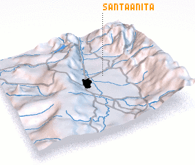 Places with similar names to Santa Anita, Colombia ::
// Santa Anita (BR)
// Santa Anita (US)
// San Donato (IT)
// San Donato (IT)
// San Donato (IT)
// San Donato (IT)
// San Donato (IT)
// San Donato (IT)
// San Donato (IT)
// San Donato (IT)
Disclaimer :: Information on this page comes without warranty of any kind |
||
|
Where is Santa Anita? Elevation and coordinates ::
Latitude (lat): 3°35'36"N Longitude (lon): 76°19'46"W
Elevation (approx.): 996m (map arrows pan, magnifying glasses zoom) |
||
|
Visiting Santa Anita? Hotel/Accommodation ::
Book a hotel in Santa Anita Travel Guide ::
Buy a travel guide for Colombia rental cars ::
car rental offers GPS waypoint ::
download a GPX waypoint (PoI) of Santa Anita for your GPS receiver
|
||