|
search place name
|
||
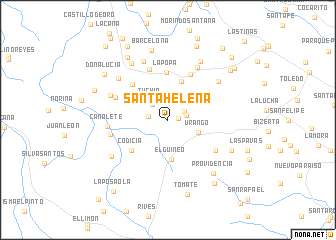
Santa Helena (Córdoba, Colombia)Santa Helena is a town in the Córdoba region of Colombia. An overview map of the region around Santa Helena is displayed below.
regional and 3d topo map of Santa Helena, Colombia ::
Santa Helena airports ::
The nearest airport is MTR - Monteria Los Garzones, located 39.1 km east of Santa Helena.
Other airports nearby include CZU - Corozal Las Brujas (114.8 km north east), MGN - Magangue Baracoa (156.3 km east), CTG - Cartagena Rafael Nunez (196.2 km north), OTU - Otu (255.2 km south east), Nearby towns ::
La Gloria (1.1km east) //
Pueblomocho (2.0km north east) //
Risaranda (2.1km east) //
Águila (2.2km west) //
Gaira (2.4km north west) //
Tuchin (2.9km north west) //
Urango (3.7km south east) //
El Guineo (4.5km south) //
La Ceiba (4.5km north) //
Codicia (5.3km south west) //
La Popa (5.3km north) //
Montenegro (5.5km north west) //
La Seba (5.7km north east) //
El Ébano (6.0km north) //
La Macoca (6.2km south east) //
No Hay Como Dios (6.3km north west) //
Las Marias (6.6km west) //
Casa Rubia (6.8km north east) //
Canalete (6.8km west) //
Armenia (6.9km north west) //
Los Ojilos (7.0km north east) //
Los Placeres (7.1km north) //
Los Esquimales (7.2km north west) //
Pocotegusta (7.5km north east) //
Alemania (7.5km north west) //
La Bodega (7.5km south west) //
Providencia (7.8km south east) //
Flojero (7.7km south east) //
Barcelona (7.9km north) //
[all distances 'as the bird flies' and approximate]  Places with similar names to Santa Helena, Colombia ::
// Santa Helena (BR)
// Santa Helena (BR)
// Santa Helena (BR)
// Santa Helena (BR)
// Santa Helena (BR)
// Santa Helena (BR)
// Santa Helena (BR)
// Santa Helena (BR)
// Santa Helena (BR)
// Santa Helena (BR)
Disclaimer :: Information on this page comes without warranty of any kind |
||
|
Where is Santa Helena? Elevation and coordinates ::
Latitude (lat): 8°47'49"N Longitude (lon): 76°10'48"W
Elevation (approx.): 83m (map arrows pan, magnifying glasses zoom) |
||
|
Visiting Santa Helena? Hotel/Accommodation ::
Book a hotel in Santa Helena Travel Guide ::
Buy a travel guide for Colombia rental cars ::
car rental offers GPS waypoint ::
download a GPX waypoint (PoI) of Santa Helena for your GPS receiver
|
||