|
search place name
|
||
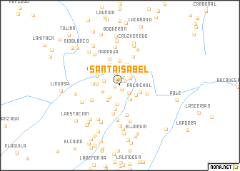
Santa Isabel (Tolima, Colombia)Santa Isabel is a town in the Tolima region of Colombia. An overview map of the region around Santa Isabel is displayed below.
regional and 3d topo map of Santa Isabel, Colombia ::
Santa Isabel airports ::
The nearest airport is NVA - Neiva Benito Salas, located 68.8 km south east of Santa Isabel.
Other airports nearby include CLO - Cali Alfonso Bonilla Aragon Intl (84.8 km west), ULQ - Tulua Farfan (95.9 km north west), AXM - Armenia El Eden (108.9 km north), IBE - Ibague Perales (117.5 km north east), Nearby towns ::
Los Escombros (0.7km south) //
La Primavera (0.8km west) //
La Esperanza (1.0km north east) //
El Teodolito (1.3km north) //
Colombia (1.8km south east) //
El Consuelo (1.9km north) //
Bellavista (2.0km north east) //
El Diamante (2.2km north) //
Peñón Morado (2.4km south west) //
Las Delicias (2.6km west) //
La Triguera (2.7km south east) //
La Mesada de Palmichal (2.9km south east) //
Cajones (2.9km west) //
El Jardín (3.0km south) //
El Encanto (3.1km south west) //
La Cabaña (3.2km north east) //
Palmichal (3.4km east) //
La Palma (3.5km north) //
Las Palmas (3.6km north west) //
Santana (3.6km west) //
Palmichal (3.8km north) //
ElHoyo (3.8km south) //
Verdún (3.9km west) //
La Esperanza (4.2km west) //
Norte de Atá (4.4km east) //
Marmaja (4.5km north) //
Los Laureles (4.5km south) //
San Pablo (4.7km south) //
La Soledad (4.9km north east) //
[all distances 'as the bird flies' and approximate] 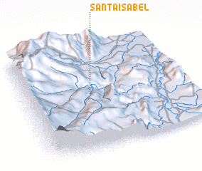 Places with similar names to Santa Isabel, Colombia ::
// Santa Isabel (BR)
// Santa Isabel (BR)
// Santa Isabel (BR)
// Santa Isabel (BR)
// Santa Isabel (BR)
// Santa Isabel (BR)
// Santa Isabel (BR)
// Santa Isabel (BR)
// Santa Isabel (BR)
// Santa Isabel (BR)
Disclaimer :: Information on this page comes without warranty of any kind |
||
|
Where is Santa Isabel? Elevation and coordinates ::
Latitude (lat): 3°28'43"N Longitude (lon): 75°37'15"W
Elevation (approx.): 1165m (map arrows pan, magnifying glasses zoom) |
||
|
Visiting Santa Isabel? Hotel/Accommodation ::
Book a hotel in Santa Isabel Travel Guide ::
Buy a travel guide for Colombia rental cars ::
car rental offers GPS waypoint ::
download a GPX waypoint (PoI) of Santa Isabel for your GPS receiver
|
||