|
search place name
|
||
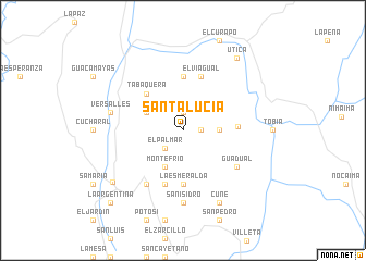
Santa Lucía (Cundinamarca, Colombia)Santa Lucía is a town in the Cundinamarca region of Colombia. An overview map of the region around Santa Lucía is displayed below.
regional and 3d topo map of Santa Lucía, Colombia ::
Santa Lucía airports ::
The nearest airport is BOG - Bogota Eldorado Intl, located 62.8 km south east of Santa Lucía.
Other airports nearby include IBE - Ibague Perales (101.7 km south west), MZL - Manizales La Nubia (103.7 km west), PEI - Pereira Matecana (137.9 km west), VVC - Villavicencio Vanguardia (146.4 km south east), Nearby towns ::
San Luis (1.8km east) //
El Gramalotal (1.9km north) //
El Palmar (2.6km south west) //
San Carlos (3.7km east) //
San José (4.1km north west) //
Monte Frío (4.1km south west) //
Tabaquera (5.2km north west) //
La Esmeralda (5.6km south) //
El Escritorio (5.6km north) //
Quebradanegra (5.6km east) //
El Viagual (5.9km north) //
El Columpio (5.9km south) //
Guadual (6.7km south east) //
Granada (6.7km south west) //
Chipauta (6.7km south west) //
San Isidro (7.4km south) //
Versalles (7.6km west) //
Cune (8.3km south east) //
Guaduas (8.9km south west) //
El Descanso (9.3km north east) //
Utica (9.3km north east) //
La Argentina (10.5km south west) //
[all distances 'as the bird flies' and approximate]  Places with similar names to Santa Lucía, Colombia ::
// Santa Lúcia (BR)
// Santa Lucia (US)
// Zandlach (AT)
// Santa Lucía (PA)
// Santa Lucia (IT)
// Santa Lucia (IT)
// Santa Lucia (IT)
// Santa Lucia (IT)
// Santa Lucia (IT)
// Santa Lucia (IT)
Disclaimer :: Information on this page comes without warranty of any kind |
||
|
Where is Santa Lucía? Elevation and coordinates ::
Latitude (lat): 5°7'0"N Longitude (lon): 74°32'0"W
Elevation (approx.): 1486m (map arrows pan, magnifying glasses zoom) |
||
|
Visiting Santa Lucía? Hotel/Accommodation ::
Book a hotel in Santa Lucía Travel Guide ::
Buy a travel guide for Colombia rental cars ::
car rental offers GPS waypoint ::
download a GPX waypoint (PoI) of Santa Lucía for your GPS receiver
|
||