|
search place name
|
||
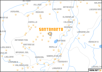
Santa Marta (Córdoba, Colombia)Santa Marta is a town in the Córdoba region of Colombia. An overview map of the region around Santa Marta is displayed below.
regional and 3d topo map of Santa Marta, Colombia ::
Santa Marta airports ::
The nearest airport is MTR - Monteria Los Garzones, located 48.0 km north east of Santa Marta.
Other airports nearby include CZU - Corozal Las Brujas (128.5 km north east), MGN - Magangue Baracoa (160.9 km north east), OTU - Otu (215.9 km south east), CTG - Cartagena Rafael Nunez (228.2 km north), Nearby towns ::
Pueblo Mocho (0.7km south) //
Los Pájaros (1.5km north west) //
Los Taburetes (2.2km south west) //
Todos No Van (2.9km west) //
Campoalegre (3.5km south west) //
La Puente (4.0km west) //
Las Palomas (4.6km east) //
Hurtado (4.8km south east) //
Hacienda La Granjita (4.9km west) //
Pepillo (5.3km south) //
San Gabriel (5.6km west) //
El Chiquero (5.9km south east) //
La Platanera (6.3km south east) //
Filadelfia (6.6km north west) //
La Machena (6.7km west) //
Medrano (6.8km east) //
Palmira (7.6km north west) //
Gurrayao (7.6km south east) //
Carrillo (7.6km north west) //
Colombia (7.6km north east) //
El Cucharo Arriba (7.9km north west) //
El Jardín (8.0km west) //
La Fortuna (8.2km north) //
Nicaragua (8.3km north west) //
Sobre Las Olas (8.6km south) //
El Cebral (8.6km south) //
Pereira (8.8km north west) //
El Naranjo (8.7km north east) //
La Esperanza (8.9km north west) //
[all distances 'as the bird flies' and approximate]  Places with similar names to Santa Marta, Colombia ::
// Santa Marta (PA)
// Santa Marta (PA)
// Santa Marta (PA)
// Santa Marta (PA)
// Santa Marta (PA)
// Santa Marta (IT)
// Santa Marta (PT)
// Santa Marta (PT)
// Santa Marta (PT)
// Santa Marta (PT)
Disclaimer :: Information on this page comes without warranty of any kind |
||
|
Where is Santa Marta? Elevation and coordinates ::
Latitude (lat): 8°26'48"N Longitude (lon): 76°2'30"W
Elevation (approx.): 36m (map arrows pan, magnifying glasses zoom) |
||
|
Visiting Santa Marta? Hotel/Accommodation ::
Book a hotel in Santa Marta Travel Guide ::
Buy a travel guide for Colombia rental cars ::
car rental offers GPS waypoint ::
download a GPX waypoint (PoI) of Santa Marta for your GPS receiver
|
||