|
search place name
|
||
Santa Rita (Atlántico, Colombia)Santa Rita is a town in the Atlántico region of Colombia. An overview map of the region around Santa Rita is displayed below.
regional and 3d topo map of Santa Rita, Colombia ::

Santa Rita airports ::
The nearest airport is BAQ - Barranquilla Ernesto Cortissoz, located 37.6 km north of Santa Rita.
Other airports nearby include CTG - Cartagena Rafael Nunez (82.6 km west), SMR - Santa Marta Simon Bolivar (86.1 km north east), MGN - Magangue Baracoa (140.2 km south), CZU - Corozal Las Brujas (146.2 km south west), Nearby towns ::
La Giralda (2.6km south west) //
El Uvero (2.6km north east) //
Palestina (2.6km south east) //
Monte Grande (2.6km north east) //
Albricias (3.6km west) //
Calentura (3.7km south) //
Loma Arena (4.1km north west) //
Campamento (4.1km south west) //
La Palma (4.1km south east) //
El Carmen (4.1km south east) //
La Cruz (4.1km south east) //
Julio (5.2km north) //
La Montaña (5.2km north west) //
San Fernando (5.9km north) //
San Espedito (5.9km north) //
Arroyo Cojo (5.9km north) //
Los Mangos (5.8km east) //
Juan Luis (5.8km east) //
Los Corrales (5.8km east) //
Tequendama (5.8km east) //
La Florida (5.8km east) //
Guaimaro (6.6km north east) //
Guayepo (6.6km north west) //
Giraldito (6.6km south west) //
Los Olvidos (6.6km north east) //
Cardonal (6.8km south east) //
Salamina (7.2km south west) //
Vindal (7.6km south) //
La Lucha (7.5km east) //
[all distances 'as the bird flies' and approximate] 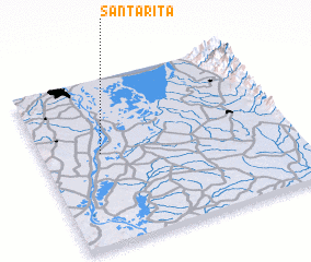 Places with similar names to Santa Rita, Colombia ::
// Santa Rita (BR)
// Santa Rita (BR)
// Santa Rita (BR)
// Santa Rita (BR)
// Santa Rita (BR)
// Santa Rita (BR)
// Santa Rita (BR)
// Santa Rita (BR)
// Santa Rita (BR)
// Santa Rita (BR)
Disclaimer :: Information on this page comes without warranty of any kind |
||
|
Where is Santa Rita? Elevation and coordinates ::
Latitude (lat): 10°33'0"N Longitude (lon): 74°46'0"W
Elevation (approx.): 4m (map arrows pan, magnifying glasses zoom) |
||
|
Visiting Santa Rita? Hotel/Accommodation ::
Book a hotel in Santa Rita Travel Guide ::
Buy a travel guide for Colombia rental cars ::
car rental offers GPS waypoint ::
download a GPX waypoint (PoI) of Santa Rita for your GPS receiver
|
||