|
search place name
|
||
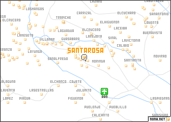
Santa Rosa (Cauca, Colombia)Santa Rosa is a town in the Cauca region of Colombia. An overview map of the region around Santa Rosa is displayed below.
regional and 3d topo map of Santa Rosa, Colombia ::
Santa Rosa airports ::
The nearest airport is PPN - Popayan Guillermo Leon Valencia, located 7.9 km south east of Santa Rosa.
Other airports nearby include CLO - Cali Alfonso Bonilla Aragon Intl (117.4 km north), GPI - Guapi Juan Casiano (139.4 km west), PSO - Pasto Antonio Narino (143.0 km south west), BUN - Buenaventura Gerardo Tobar Lopez (149.2 km north), Nearby towns ::
Santa Helena (0.6km east) //
Campo Bello (1.1km west) //
La Laja (1.2km south west) //
Santa Teresa (1.4km south) //
La Primavera (1.8km west) //
Santa Ana (2.4km west) //
La Esperanza (2.5km north west) //
Morinda (3.0km east) //
Buenavista (3.4km north west) //
La Peña (4.2km north west) //
La Coronilla (4.5km north east) //
La Rejoya (4.9km north) //
Guasabaro (5.1km north west) //
La Violeta (5.3km north east) //
Bernardino (5.3km east) //
Cajete (5.8km south) //
La Rejoya (5.9km east) //
La Rejoya (6.1km east) //
San Alfredo (6.1km west) //
El Crucero (6.1km north) //
Campo Alegre (6.3km north) //
Altamira (6.3km north west) //
La Selva (6.5km east) //
El Guayabo (7.0km north west) //
La Guadua (7.2km north west) //
Julumito (7.3km south) //
Sinal (7.3km north east) //
Casas Viejas (7.5km north west) //
El Charco (8.0km south west) //
[all distances 'as the bird flies' and approximate] 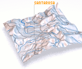 Places with similar names to Santa Rosa, Colombia ::
// Sania Torres (MA)
// Santa Rosa (BR)
// Santa Rosa (BR)
// Santa Rosa (BR)
// Santa Rosa (BR)
// Santa Rosa (BR)
// Santa Rosa (BR)
// Santa Rosa (BR)
// Santa Rosa (BR)
// Santa Rosa (BR)
Disclaimer :: Information on this page comes without warranty of any kind |
||
|
Where is Santa Rosa? Elevation and coordinates ::
Latitude (lat): 2°30'55"N Longitude (lon): 76°38'48"W
Elevation (approx.): 1754m (map arrows pan, magnifying glasses zoom) |
||
|
Visiting Santa Rosa? Hotel/Accommodation ::
Book a hotel in Santa Rosa Travel Guide ::
Buy a travel guide for Colombia rental cars ::
car rental offers GPS waypoint ::
download a GPX waypoint (PoI) of Santa Rosa for your GPS receiver
|
||