|
search place name
|
||
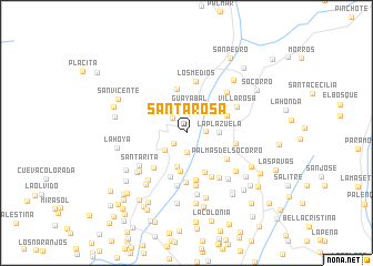
Santa Rosa (Santander, Colombia)Santa Rosa is a town in the Santander region of Colombia. An overview map of the region around Santa Rosa is displayed below.
regional and 3d topo map of Santa Rosa, Colombia ::
Santa Rosa airports ::
The nearest airport is BGA - Bucaramanga Palonegro, located 78.5 km north of Santa Rosa.
Other airports nearby include EJA - Barrancabermeja Yariguies (84.5 km north west), OTU - Otu (166.5 km north west), TME - Tame (173.1 km east), SVZ - San Antonio Del Tachira (184.1 km north east), Nearby towns ::
La Llanita (1.7km south west) //
El Espumal (1.9km east) //
Llano Grande (2.0km south) //
Simacota (2.0km north west) //
Guayabal (2.6km north) //
Buenavista (2.8km south west) //
La Plazuela (3.3km east) //
Barro Hondo (3.5km south) //
Santo Domingo (3.9km south) //
San Vicente (4.3km south east) //
Barlovento (4.4km north east) //
Santana de Flores (4.6km north) //
Boquerón (4.7km south) //
Villa Dorada (4.8km south) //
Santa Bárbara (4.8km south west) //
Palmas del Socorro (4.9km south east) //
Tierra Amarilla (5.0km south) //
Villa Gómez (5.0km east) //
Barro Blanco (5.1km south east) //
Los Medios (5.2km north) //
La Teja (5.4km south) //
Germania (5.4km south) //
Lisboa (5.6km south east) //
Villa Rosa (5.7km north east) //
Chanchón (5.7km north east) //
Santa Rita (5.8km south west) //
Las Arenas (6.0km south west) //
Maravilla (6.1km south west) //
San Pedro (6.3km south) //
[all distances 'as the bird flies' and approximate]  Places with similar names to Santa Rosa, Colombia ::
// Sania Torres (MA)
// Santa Rosa (BR)
// Santa Rosa (BR)
// Santa Rosa (BR)
// Santa Rosa (BR)
// Santa Rosa (BR)
// Santa Rosa (BR)
// Santa Rosa (BR)
// Santa Rosa (BR)
// Santa Rosa (BR)
Disclaimer :: Information on this page comes without warranty of any kind |
||
|
Where is Santa Rosa? Elevation and coordinates ::
Latitude (lat): 6°25'51"N Longitude (lon): 73°19'31"W
Elevation (approx.): 786m (map arrows pan, magnifying glasses zoom) |
||
|
Visiting Santa Rosa? Hotel/Accommodation ::
Book a hotel in Santa Rosa Travel Guide ::
Buy a travel guide for Colombia rental cars ::
car rental offers GPS waypoint ::
download a GPX waypoint (PoI) of Santa Rosa for your GPS receiver
|
||