|
search place name
|
||
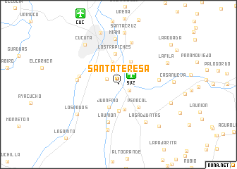
Santa Teresa (Norte de Santander, Colombia)Santa Teresa is a town in the Norte de Santander region of Colombia. An overview map of the region around Santa Teresa is displayed below.
regional and 3d topo map of Santa Teresa, Colombia ::
Santa Teresa airports ::
The nearest airport is SVZ - San Antonio Del Tachira, located 2.6 km north east of Santa Teresa.
Other airports nearby include CUC - Cucuta Camilo Daza (12.6 km north west), LFR - La Fria (50.1 km north east), STD - Santo Domingo Mayor Buenaventura Vivas (54.9 km south east), BGA - Bucaramanga Palonegro (111.5 km south west), Nearby towns ::
Villa del Rosario (2.0km north west) //
San Antonio del Táchira (2.0km south east) //
San Javier (3.6km north) //
Juan Frío (3.9km south) //
El Palotal (4.1km north east) //
El Saladito (4.1km south) //
Llano de Jorge (4.2km south) //
Peracal (4.8km south east) //
Los Trapiches (4.8km north) //
La Unión (6.2km south) //
Los Patios (6.2km west) //
Las Lomas (6.4km east) //
San Pedro (6.5km west) //
Las Tienditas (7.0km north) //
Miami (7.2km north) //
Las Adjuntas (7.3km south east) //
Miraflores (7.4km south) //
Los Vados (8.0km south west) //
Cúcuta (8.2km north west) //
Santa Cruz (8.2km north) //
La Fila (8.4km north east) //
San Luis (8.6km north) //
Casa Nueva (8.7km east) //
Apartaderos (8.8km east) //
San Francisco (9.2km south east) //
La Aguada (10.4km north east) //
La Garita (11.9km south west) //
[all distances 'as the bird flies' and approximate] 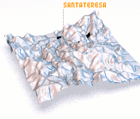 Places with similar names to Santa Teresa, Colombia ::
// Santa Teresa (BR)
// Santa Teresa (BR)
// Santa Teresa (BR)
// Santa Teresa (BR)
// Santa Teresa (BR)
// Santa Teresa (BR)
// Santa Teresa (BR)
// Santa Teresa (BR)
// Santa Teresa (BR)
// Santa Teresa (BR)
Disclaimer :: Information on this page comes without warranty of any kind |
||
|
Where is Santa Teresa? Elevation and coordinates ::
Latitude (lat): 7°49'35"N Longitude (lon): 72°27'29"W
Elevation (approx.): 406m (map arrows pan, magnifying glasses zoom) |
||
|
Visiting Santa Teresa? Hotel/Accommodation ::
Book a hotel in Santa Teresa Travel Guide ::
Buy a travel guide for Colombia rental cars ::
car rental offers GPS waypoint ::
download a GPX waypoint (PoI) of Santa Teresa for your GPS receiver
|
||