|
search place name
|
||
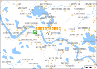
Santa Teresa (Magdalena, Colombia)Santa Teresa is a town in the Magdalena region of Colombia. An overview map of the region around Santa Teresa is displayed below.
regional and 3d topo map of Santa Teresa, Colombia ::
Santa Teresa airports ::
The nearest airport is MGN - Magangue Baracoa, located 50.0 km west of Santa Teresa.
Other airports nearby include CZU - Corozal Las Brujas (98.6 km west), OCV - Ocana Aguas Claras (153.8 km south east), MTR - Monteria Los Garzones (164.6 km west), CTG - Cartagena Rafael Nunez (180.2 km north west), Nearby towns ::
Las Panelas (1.0km east) //
Guinea (1.0km north) //
Bermejal (1.8km north east) //
Tierra Firme (2.4km south) //
Carrillo (2.8km east) //
Troncosito (3.3km south) //
Mompos (3.4km south west) //
Troncoso (3.6km south) //
Las Mercedes (3.7km north) //
Mompós (3.9km west) //
San Sebastián (4.2km east) //
San Sebastián de Buenavista (4.2km east) //
Puesto de Monta (4.7km south west) //
Guásimo (4.9km east) //
Los Gúaimaros (5.1km south) //
Chambacú (5.5km north) //
El Horno (5.8km north west) //
El Triunfo (5.9km south west) //
Guataca (6.0km south east) //
Angostura (6.1km north) //
Sincahecha (6.1km north west) //
Menchiquejo (6.0km south east) //
La Colonia (6.3km south west) //
San Pedro (6.4km west) //
Las Flores (6.7km east) //
Las Islitas (7.3km north) //
Berlín (7.4km north) //
Puerto Arturo (7.3km north west) //
La Esperanza (7.4km south west) //
[all distances 'as the bird flies' and approximate] 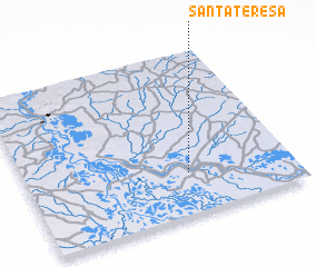 Places with similar names to Santa Teresa, Colombia ::
// Santa Teresa (BR)
// Santa Teresa (BR)
// Santa Teresa (BR)
// Santa Teresa (BR)
// Santa Teresa (BR)
// Santa Teresa (BR)
// Santa Teresa (BR)
// Santa Teresa (BR)
// Santa Teresa (BR)
// Santa Teresa (BR)
Disclaimer :: Information on this page comes without warranty of any kind |
||
|
Where is Santa Teresa? Elevation and coordinates ::
Latitude (lat): 9°15'4"N Longitude (lon): 74°23'31"W
Elevation (approx.): 21m (map arrows pan, magnifying glasses zoom) |
||
|
Visiting Santa Teresa? Hotel/Accommodation ::
Book a hotel in Santa Teresa Travel Guide ::
Buy a travel guide for Colombia rental cars ::
car rental offers GPS waypoint ::
download a GPX waypoint (PoI) of Santa Teresa for your GPS receiver
|
||