|
search place name
|
||
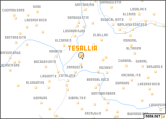
Tesallia (Boyacá, Colombia)Tesallia is a town in the Boyacá region of Colombia. An overview map of the region around Tesallia is displayed below.
regional and 3d topo map of Tesallia, Colombia ::
Tesallia airports ::
The nearest airport is VVC - Villavicencio Vanguardia, located 75.9 km south west of Tesallia.
Other airports nearby include BOG - Bogota Eldorado Intl (97.7 km west), IBE - Ibague Perales (210.3 km west), TME - Tame (250.7 km north east), Nearby towns ::
Charco Largo (1.2km south west) //
Zaragoza (3.3km south west) //
Cieba Grande (4.2km north east) //
La Vega del Carmen (4.3km south east) //
Santa Ana (4.6km east) //
Balcones (5.2km east) //
El Carmen (5.3km north west) //
Los Naranjos (5.6km north) //
Cataluña (5.8km south west) //
Mámbita (6.0km west) //
El Billar (6.0km north east) //
Nazareth (6.1km south east) //
Nazaret (6.1km south east) //
Santa Lucia (6.2km south west) //
Barro Blanco (6.6km south east) //
Soya (6.9km south west) //
La Romaza (6.9km south east) //
Volcanera (7.4km north) //
San Luis (7.6km south west) //
San Isidro (7.6km north) //
San Augustin (8.4km north) //
La Volcanera (8.4km north) //
Boca de Monte (8.6km west) //
La Suerte (9.1km south west) //
Santa Barbara (10.0km south east) //
San Luis (10.0km south west) //
Aguacaliente (10.4km north east) //
Esparramos (10.7km north east) //
[all distances 'as the bird flies' and approximate] 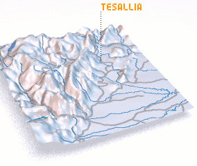 Places with similar names to Tesallia, Colombia ::
Disclaimer :: Information on this page comes without warranty of any kind |
||
|
Where is Tesallia? Elevation and coordinates ::
Latitude (lat): 4°45'38"N Longitude (lon): 73°16'7"W
Elevation (approx.): 678m (map arrows pan, magnifying glasses zoom) |
||
|
Visiting Tesallia? Hotel/Accommodation ::
Book a hotel in Tesallia Travel Guide ::
Buy a travel guide for Colombia rental cars ::
car rental offers GPS waypoint ::
download a GPX waypoint (PoI) of Tesallia for your GPS receiver
|
||