|
search place name
|
||
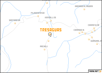
Tres Aguas (Norte de Santander, Colombia)Tres Aguas is a town in the Norte de Santander region of Colombia. An overview map of the region around Tres Aguas is displayed below.
regional and 3d topo map of Tres Aguas, Colombia ::
Tres Aguas airports ::
The nearest airport is OCV - Ocana Aguas Claras, located 58.0 km south west of Tres Aguas.
Other airports nearby include LFR - La Fria (80.9 km south east), CUC - Cucuta Camilo Daza (86.0 km south east), SVZ - San Antonio Del Tachira (98.3 km south east), STB - Santa Barbara Del Zulia (114.7 km east), Nearby towns ::
Pata de Caballo (1.9km south west) //
La Escuadra (2.5km north west) //
Pacheli (5.3km south west) //
Orú (5.3km north) //
Versalles (5.9km north) //
Filo de Gringo (8.9km north west) //
[all distances 'as the bird flies' and approximate]  Places with similar names to Tres Aguas, Colombia ::
// Drzykozy (PL)
// Törsökös (HU)
// Draškići (BA)
// Druskas (LV)
// Troškas (LV)
// Troškas (LV)
// Darısekisi (TR)
// Trece Aguas (GT)
// Trézioux (FR)
// Dražgoše (SI)
Disclaimer :: Information on this page comes without warranty of any kind |
||
|
Where is Tres Aguas? Elevation and coordinates ::
Latitude (lat): 8°35'41"N Longitude (lon): 72°54'46"W
Elevation (approx.): 154m (map arrows pan, magnifying glasses zoom) |
||
|
Visiting Tres Aguas? Hotel/Accommodation ::
Book a hotel in Tres Aguas Travel Guide ::
Buy a travel guide for Colombia rental cars ::
car rental offers GPS waypoint ::
download a GPX waypoint (PoI) of Tres Aguas for your GPS receiver
|
||