|
search place name
|
||
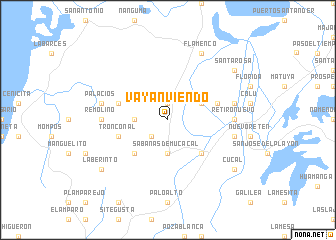
Vayanviendo (Bolívar, Colombia)Vayanviendo is a town in the Bolívar region of Colombia. An overview map of the region around Vayanviendo is displayed below.
regional and 3d topo map of Vayanviendo, Colombia ::
Vayanviendo airports ::
The nearest airport is CTG - Cartagena Rafael Nunez, located 58.8 km north of Vayanviendo.
Other airports nearby include CZU - Corozal Las Brujas (66.6 km south), MGN - Magangue Baracoa (95.1 km south east), MTR - Monteria Los Garzones (128.3 km south), BAQ - Barranquilla Ernesto Cortissoz (129.2 km north east), Nearby towns ::
El Níspero (1.9km north) //
Sabanas de Angola (2.6km south west) //
Sabanas de Mucacal (3.7km south) //
Chiquillo (3.7km west) //
Los Vijaos (4.1km north east) //
Pueblo Nuevo (5.2km south east) //
Hondo (5.2km south west) //
Los Bellos (5.8km east) //
El Comienzo (5.8km west) //
Tronconal (5.8km west) //
Retiro Nuevo (7.3km east) //
Remolino (7.3km west) //
Cedro (7.5km east) //
Arroyo Grande (7.5km east) //
Palacios (7.5km west) //
Flamenco (8.3km north east) //
Santa Rosa (9.2km north east) //
Cucal (9.2km south east) //
Laberinto (9.2km south west) //
[all distances 'as the bird flies' and approximate] 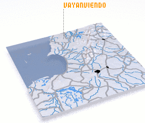 Places with similar names to Vayanviendo, Colombia ::
// Vayan Viendo (CO)
Disclaimer :: Information on this page comes without warranty of any kind |
||
|
Where is Vayanviendo? Elevation and coordinates ::
Latitude (lat): 9°55'0"N Longitude (lon): 75°26'0"W
Elevation (approx.): 26m (map arrows pan, magnifying glasses zoom) |
||
|
Visiting Vayanviendo? Hotel/Accommodation ::
Book a hotel in Vayanviendo Travel Guide ::
Buy a travel guide for Colombia rental cars ::
car rental offers GPS waypoint ::
download a GPX waypoint (PoI) of Vayanviendo for your GPS receiver
|
||