|
search place name
|
||
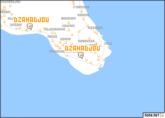
Dzahadjou (Grande Comore, Comoros)Dzahadjou is a town in the Grande Comore region of Comoros. An overview map of the region around Dzahadjou is displayed below.
regional and 3d topo map of Dzahadjou, Comoros ::
Dzahadjou airports ::
The nearest airport is HAH - Moroni Prince Said Ibrahim, located 45.5 km north west of Dzahadjou.
Other airports nearby include NWA - Moheli Bandaressalam (55.6 km south east), AJN - Anjouan Ouani (110.2 km east), DZA - Dzaoudzi Pamandzi (223.0 km south east), Nearby towns ::
Hada-Haïa (0.9km east) //
Sima Ambouani (2.1km south east) //
Kourani-Mkanga (2.3km north) //
Bandamadji (2.5km north east) //
Ngnambéni (3.2km north east) //
Simboussa (3.3km north) //
Inané (3.2km north east) //
Midjendjéni (3.4km east) //
Ifoundihé Chambouani (3.6km west) //
Ndzouani (3.6km east) //
Ouziouani (3.8km north west) //
Dzouadjou (4.2km north west) //
Chindini (4.2km east) //
Dima (4.4km north west) //
Kové (4.7km north east) //
Ourovéni (4.8km east) //
Mlalouankoudjou (5.0km north) //
Didjoni (5.0km north east) //
Domoni (5.2km north west) //
Mdji Diakagnoa (5.5km north west) //
Mlimani (5.6km north west) //
Mandzissani (5.8km north west) //
Famaré (5.9km north west) //
Nioumamilima (6.4km north) //
Dembéni (6.3km north west) //
Male (6.3km north east) //
Ourondroni (6.4km north west) //
Kouambani (6.6km north east) //
Foumbouni (6.7km north east) //
[all distances 'as the bird flies' and approximate] 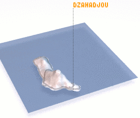 Places with similar names to Dzahadjou, Comoros ::
Disclaimer :: Information on this page comes without warranty of any kind |
||
|
Where is Dzahadjou? Elevation and coordinates ::
Latitude (lat): 11°54'28"S Longitude (lon): 43°26'40"E
Elevation (approx.): 110m (map arrows pan, magnifying glasses zoom) |
||
|
Visiting Dzahadjou? Hotel/Accommodation ::
Book a hotel in Dzahadjou Travel Guide ::
Buy a travel guide for Comoros rental cars ::
car rental offers GPS waypoint ::
download a GPX waypoint (PoI) of Dzahadjou for your GPS receiver
|
||