|
search place name
|
||
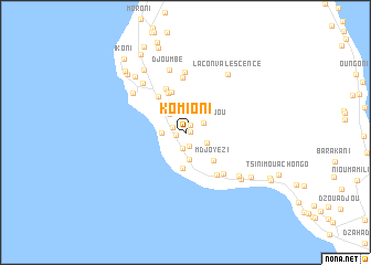
Komioni (Grande Comore, Comoros)Komioni is a town in the Grande Comore region of Comoros. An overview map of the region around Komioni is displayed below.
regional and 3d topo map of Komioni, Comoros ::
Komioni airports ::
The nearest airport is HAH - Moroni Prince Said Ibrahim, located 30.3 km north of Komioni.
Other airports nearby include NWA - Moheli Bandaressalam (75.8 km south east), AJN - Anjouan Ouani (130.2 km east), Nearby towns ::
Djoumouachongo (0.5km east) //
Magaridjou (0.8km north east) //
Mitsoudjé (0.9km west) //
Zikaledjou (1.4km north west) //
Chouani (1.4km south) //
Madjeouéni (1.6km south) //
Nioumbadjou (2.0km north east) //
Bangoi (2.3km south east) //
Salimani (2.4km west) //
Nioumadzaha (2.4km north west) //
Hamsaoua (2.7km south) //
Séléa (3.3km north west) //
Bangoua (3.7km south) //
Mdjoyézi (4.0km south east) //
Dzahani (4.3km north) //
Boudé-Adjou (4.3km north west) //
Mouandzaza Djoumbé (4.6km north west) //
Daouéni (4.8km north west) //
Singani (5.3km south east) //
Djitaché (5.6km north) //
Hetsa (5.6km south east) //
Boboni (6.1km north) //
Boboni (6.1km north) //
Djoumbe (6.5km north) //
Ndroini (6.6km north west) //
Mouandzaza Ambouani (6.6km north west) //
Samba (6.9km south east) //
La Convalescence (7.2km north east) //
Mbambani (7.2km south east) //
[all distances 'as the bird flies' and approximate]  Places with similar names to Komioni, Comoros ::
Disclaimer :: Information on this page comes without warranty of any kind |
||
|
Where is Komioni? Elevation and coordinates ::
Latitude (lat): 11°48'26"S Longitude (lon): 43°16'51"E
Elevation (approx.): 66m (map arrows pan, magnifying glasses zoom) |
||
|
Visiting Komioni? Hotel/Accommodation ::
Book a hotel in Komioni Travel Guide ::
Buy a travel guide for Comoros rental cars ::
car rental offers GPS waypoint ::
download a GPX waypoint (PoI) of Komioni for your GPS receiver
|
||