|
search place name
|
||
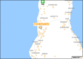
Zivandani (Grande Comore, Comoros)Zivandani is a town in the Grande Comore region of Comoros. An overview map of the region around Zivandani is displayed below.
regional and 3d topo map of Zivandani, Comoros ::
Zivandani airports ::
The nearest airport is HAH - Moroni Prince Said Ibrahim, located 12.4 km north of Zivandani.
Other airports nearby include NWA - Moheli Bandaressalam (90.4 km south east), AJN - Anjouan Ouani (137.8 km south east), Nearby towns ::
Sambakouni (0.9km east) //
Gouni (1.3km south west) //
Vouadjou (1.6km north west) //
Ntsoudjini (1.6km south) //
Dzahani (1.7km south east) //
Milembéni (1.8km south) //
Ouella (1.8km south east) //
Hantsambou (1.9km south west) //
Sima (1.9km east) //
Batsa (2.0km north) //
Minassini (2.1km south east) //
Bahani (2.1km east) //
Bandamadji (2.3km south) //
Dzahadjou (2.4km north east) //
Samba (2.5km south) //
Mdé (3.0km south) //
Itsandra (3.1km south west) //
Dimadjou (3.2km south) //
Maouéni (3.3km south) //
Itsambouni (3.7km south) //
Salimani (3.8km south) //
Vounambadani (3.9km north) //
Vanambouani (4.1km north) //
Vanadjou (4.4km north) //
Tsidjé (5.8km south) //
Oussivo (6.8km north) //
Moroni (7.1km south west) //
Bangahani (7.5km north) //
Daché (7.6km south) //
[all distances 'as the bird flies' and approximate] 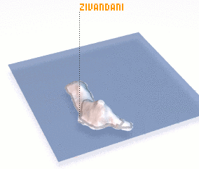 Places with similar names to Zivandani, Comoros ::
// Švendūna (LT)
// Zafintany (MG)
// Sévanetine (MZ)
// Sevantine (MZ)
// Sevenetine (MZ)
// Seventine (MZ)
// Seventine (MZ)
// Seventine (MZ)
// Seventine (MZ)
// Savane Diane (HT)
Disclaimer :: Information on this page comes without warranty of any kind |
||
|
Where is Zivandani? Elevation and coordinates ::
Latitude (lat): 11°38'45"S Longitude (lon): 43°15'57"E
Elevation (approx.): 85m (map arrows pan, magnifying glasses zoom) |
||
|
Visiting Zivandani? Hotel/Accommodation ::
Book a hotel in Zivandani Travel Guide ::
Buy a travel guide for Comoros rental cars ::
car rental offers GPS waypoint ::
download a GPX waypoint (PoI) of Zivandani for your GPS receiver
|
||