|
search place name
|
||
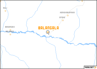
Balangala (Congo, Democratic Republic of the)Balangala is a town in Congo, Democratic Republic of the. An overview map of the region around Balangala is displayed below.
regional and 3d topo map of Balangala, Congo, Democratic Republic of the ::
Balangala airports ::
The nearest airport is MDK - Mbandaka, located 167.9 km west of Balangala.
Other airports nearby include LIQ - Lisala (275.9 km north east), Nearby towns ::
Impoko (2.6km north east) //
Efoku (7.9km north east) //
Monieka-Bafaka (10.5km north east) //
[all distances 'as the bird flies' and approximate]  Places with similar names to Balangala, Congo, Democratic Republic of the ::
// Bulangal (PH)
// Belençal (TR)
// Bulungulu (ZA)
// Bilinguili (CF)
// Balankole (CD)
// Bulungula (CD)
// Balanggala (ID)
// Bilungala (ID)
// Blanquillo (MX)
// Buleng Ulu (MY)
Disclaimer :: Information on this page comes without warranty of any kind |
||
|
Where is Balangala? Elevation and coordinates ::
Latitude (lat): 0°24'0"S Longitude (lon): 19°45'0"E
Elevation (approx.): 335m (map arrows pan, magnifying glasses zoom) |
||
|
Visiting Balangala? Hotel/Accommodation ::
Book a hotel in Balangala Travel Guide ::
rental cars ::
car rental offers GPS waypoint ::
download a GPX waypoint (PoI) of Balangala for your GPS receiver
|
||