|
search place name
|
||
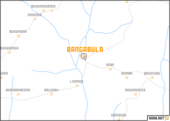
Bangabula (Congo, Democratic Republic of the)Bangabula is a town in Congo, Democratic Republic of the. An overview map of the region around Bangabula is displayed below.
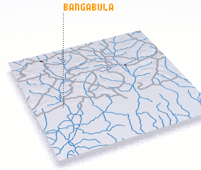
regional and 3d topo map of Bangabula, Congo, Democratic Republic of the ::
Bangabula airports ::
The nearest airport is GMA - Gemena, located 104.6 km north east of Bangabula.
Other airports nearby include BGF - Bangui M Poko (224.9 km north), BDT - Gbadolite (277.9 km north east), Nearby towns ::
 Places with similar names to Bangabula, Congo, Democratic Republic of the ::
// Bangbel (CM)
// Bangbali (CF)
// Bongbalo (CF)
// Bangabila (CD)
// Bena-Kabala (CD)
// Bena-Kabala (CD)
// Bongbola (CD)
// Bangbale (GH)
// Bangbalia (SL)
// Bongobli (LR)
Disclaimer :: Information on this page comes without warranty of any kind |
||
|
Where is Bangabula? Elevation and coordinates ::
Latitude (lat): 2°29'0"N Longitude (lon): 19°12'0"E
Elevation (approx.): 362m (map arrows pan, magnifying glasses zoom) |
||
|
Visiting Bangabula? Hotel/Accommodation ::
Book a hotel in Bangabula Travel Guide ::
rental cars ::
car rental offers GPS waypoint ::
download a GPX waypoint (PoI) of Bangabula for your GPS receiver
|
||