|
search place name
|
||
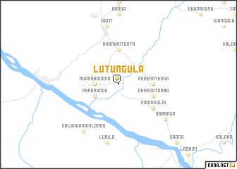
Lutungula (Congo, Democratic Republic of the)Lutungula is a town in Congo, Democratic Republic of the. An overview map of the region around Lutungula is displayed below.
regional and 3d topo map of Lutungula, Congo, Democratic Republic of the ::
Lutungula airports ::
The nearest airport is KND - Kindu, located 197.8 km north west of Lutungula.
Nearby towns ::
Mwana-Hanana (3.7km west) //
Pene-Pundu (4.1km south west) //
Mwana-Mitenta (5.6km north) //
Pene-Mayenge (5.5km east) //
Pene-Katamba (5.8km east) //
Niamakulia (6.7km south east) //
Mobanga (9.2km south east) //
Kala-Mwana-Milongo (9.3km south west) //
[all distances 'as the bird flies' and approximate] 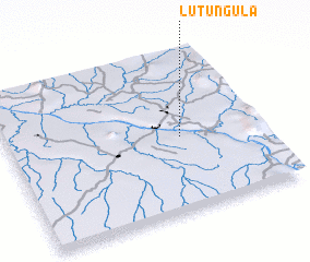 Places with similar names to Lutungula, Congo, Democratic Republic of the ::
// Ladongol (SN)
// La Tanquilla (VE)
// Litungulo (MZ)
// Ludinglu (CN)
// Lahdenkylä (FI)
// Lahdenkylä (FI)
// Lahdenkylä (FI)
// Lahdenkylä (FI)
// Lahdenkylä (FI)
// Lahdenkylä (FI)
Disclaimer :: Information on this page comes without warranty of any kind |
||
|
Where is Lutungula? Elevation and coordinates ::
Latitude (lat): 4°32'0"S Longitude (lon): 26°41'0"E
Elevation (approx.): 568m (map arrows pan, magnifying glasses zoom) |
||
|
Visiting Lutungula? Hotel/Accommodation ::
Book a hotel in Lutungula Travel Guide ::
rental cars ::
car rental offers GPS waypoint ::
download a GPX waypoint (PoI) of Lutungula for your GPS receiver
|
||