|
search place name
|
||
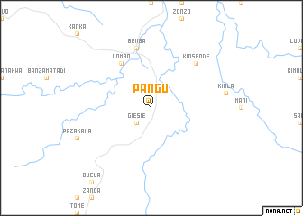
Pangu (Congo, Democratic Republic of the)Pangu is a town in Congo, Democratic Republic of the. An overview map of the region around Pangu is displayed below.
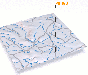
regional and 3d topo map of Pangu, Congo, Democratic Republic of the ::
Pangu airports ::
The nearest airport is SSY - M'banza-congo Mbanza Congo, located 63.3 km south west of Pangu.
Other airports nearby include NLO - Kinshasa Ndolo (184.3 km north east), FIH - Kinshasa Ndjili Intl (184.5 km north east), BZV - Brazzaville Maya Maya (188.6 km north), UGO - Uige (200.9 km south), Nearby towns ::
 Places with similar names to Pangu, Congo, Democratic Republic of the ::
Disclaimer :: Information on this page comes without warranty of any kind |
||
|
Where is Pangu? Elevation and coordinates ::
Latitude (lat): 5°50'0"S Longitude (lon): 14°37'0"E
Elevation (approx.): 467m (map arrows pan, magnifying glasses zoom) |
||
|
Visiting Pangu? Hotel/Accommodation ::
Book a hotel in Pangu Travel Guide ::
rental cars ::
car rental offers GPS waypoint ::
download a GPX waypoint (PoI) of Pangu for your GPS receiver
|
||