|
search place name
|
||
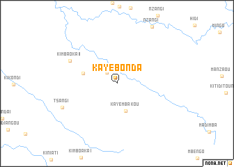
Kaye-Bonda (Niari, Congo, Republic of the)Kaye-Bonda is a town in the Niari region of Congo, Republic of the. An overview map of the region around Kaye-Bonda is displayed below.
regional and 3d topo map of Kaye-Bonda, Congo, Republic of the ::
Kaye-Bonda airports ::
The nearest airport is CAB - Cabinda, located 174.7 km south west of Kaye-Bonda.
Other airports nearby include PNR - Pointe-noire Pointe Noire (177.5 km west), MNB - Muanda (185.4 km south west), SSY - M'banza-congo Mbanza Congo (193.7 km south east), SZA - Soyo (201.8 km south west), Nearby towns ::
Kimouanda (2.3km north west) //
Kaye-Mbakou (4.6km south) //
Banda-Kayes (5.6km west) //
Kimbaoka II (8.4km north west) //
Tsangi (9.5km south west) //
[all distances 'as the bird flies' and approximate] 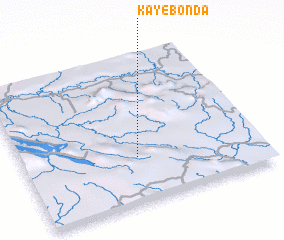 Places with similar names to Kaye-Bonda, Congo, Republic of the ::
// Cayo Bonito (CU)
// Kyebando (UG)
// Kyebando (UG)
// Kyebando (UG)
// Kyebando (UG)
// Keya Bendu (LR)
// Kyibinde (MM)
// Kyibin-et (MM)
// Kyibin-et (MM)
// Kyibin-et (MM)
Disclaimer :: Information on this page comes without warranty of any kind |
||
|
Where is Kaye-Bonda? Elevation and coordinates ::
Latitude (lat): 4°41'41"S Longitude (lon): 13°28'54"E
Elevation (approx.): 367m (map arrows pan, magnifying glasses zoom) |
||
|
Visiting Kaye-Bonda? Hotel/Accommodation ::
Book a hotel in Kaye-Bonda Travel Guide ::
rental cars ::
car rental offers GPS waypoint ::
download a GPX waypoint (PoI) of Kaye-Bonda for your GPS receiver
|
||