|
search place name
|
||
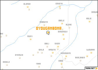
Oyou-Gamboma (Cuvette, Congo, Republic of the)Oyou-Gamboma is a town in the Cuvette region of Congo, Republic of the. An overview map of the region around Oyou-Gamboma is displayed below.
regional and 3d topo map of Oyou-Gamboma, Congo, Republic of the ::
Oyou-Gamboma airports ::
The nearest airport is OKN - Okondja, located 125.7 km west of Oyou-Gamboma.
Other airports nearby include FTX - Owando (133.0 km east), MVB - Franceville Mvengue (176.5 km south west), MKU - Makokou (262.3 km north west), Nearby towns ::
Kébouya (4.3km north west) //
Obili (4.5km south) //
Ovounigui (5.4km east) //
Letoumbou (5.5km north east) //
Ekéri (5.5km south east) //
Oka (5.9km east) //
Ewo (6.4km south east) //
Obélé (6.6km north east) //
Mpouya (6.9km south) //
Ngayi (7.2km west) //
Okila (7.3km south) //
Oboko (7.9km south west) //
Otari (8.0km south) //
Alémé (8.2km east) //
Ntsama (9.8km south west) //
Kenvouani (10.4km south east) //
[all distances 'as the bird flies' and approximate] 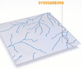 Places with similar names to Oyou-Gamboma, Congo, Republic of the :: Disclaimer :: Information on this page comes without warranty of any kind |
||
|
Where is Oyou-Gamboma? Elevation and coordinates ::
Latitude (lat): 0°49'24"S Longitude (lon): 14°47'29"E
Elevation (approx.): 461m (map arrows pan, magnifying glasses zoom) |
||
|
Visiting Oyou-Gamboma? Hotel/Accommodation ::
Book a hotel in Oyou-Gamboma Travel Guide ::
rental cars ::
car rental offers GPS waypoint ::
download a GPX waypoint (PoI) of Oyou-Gamboma for your GPS receiver
|
||