|
search place name
|
||
Caña Blanca (San José, Costa Rica)Caña Blanca is a town in the San José region of Costa Rica. An overview map of the region around Caña Blanca is displayed below.
regional and 3d topo map of Caña Blanca, Costa Rica ::

Caña Blanca airports ::
The nearest airport is XQP - Quepos La Managua, located 38.8 km west of Caña Blanca.
Other airports nearby include PMZ - Palmar Sur (54.4 km south east), SJO - San Jose Juan Santamaria Intl (87.3 km north west), GLF - Golfito (100.1 km south east), LIO - Limon Intl (111.0 km north east), Nearby towns ::
Magnolia (1.9km north) //
Tinamaste (2.6km south east) //
Guabo (3.7km west) //
Platanillo (3.7km south) //
Guaria (5.2km north east) //
Tumbas (5.2km south east) //
Barú (5.2km south west) //
San Juan (5.8km east) //
San Luis (7.4km south) //
San Antonio (7.6km north) //
Pacuar (7.5km east) //
Tierras Morenas (7.5km west) //
Laguna (7.5km west) //
Roble (7.8km north east) //
Palma (8.2km north east) //
Dominical (10.4km south west) //
[all distances 'as the bird flies' and approximate] 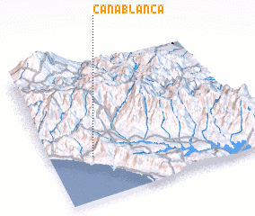 Places with similar names to Caña Blanca, Costa Rica ::
// Caña Blanca (PA)
// Caña Blanca (PA)
// Caña Blanca (PA)
// Caña Blanca (PA)
// Caña Blanca (PA)
// Caña Blanca (PA)
// Caña Blanca (PA)
// Caña Blanca (PA)
// Caño Blanco (CO)
// Caño Blanco (VE)
Disclaimer :: Information on this page comes without warranty of any kind |
||
|
Where is Caña Blanca? Elevation and coordinates ::
Latitude (lat): 9°19'0"N Longitude (lon): 83°48'0"W
Elevation (approx.): 400m (map arrows pan, magnifying glasses zoom) |
||
|
Visiting Caña Blanca? Hotel/Accommodation ::
Book a hotel in Caña Blanca Travel Guide ::
Buy a travel guide for Costa Rica rental cars ::
car rental offers GPS waypoint ::
download a GPX waypoint (PoI) of Caña Blanca for your GPS receiver
|
||