|
search place name
|
||
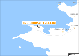
Hacienda Santa Elena (Guanacaste, Costa Rica)Hacienda Santa Elena is a town in the Guanacaste region of Costa Rica. An overview map of the region around Hacienda Santa Elena is displayed below.
regional and 3d topo map of Hacienda Santa Elena, Costa Rica ::
Hacienda Santa Elena airports ::
The nearest airport is LIR - Liberia Daniel Oduber Quiros Intl, located 49.1 km south east of Hacienda Santa Elena.
Other airports nearby include NOB - Nosara Beach Nosara (107.7 km south), MGA - Managua Intl (138.5 km north), SJO - San Jose Juan Santamaria Intl (206.0 km south east), XQP - Quepos La Managua (249.0 km south east), Nearby towns ::
[all distances 'as the bird flies' and approximate]  Places with similar names to Hacienda Santa Elena, Costa Rica ::
// Hacienda Santa Elena (EC)
// Hacienda Santa Elena (EC)
// Hacienda Santa Elena (SV)
// Hacienda Santa Elena (PE)
// Hacienda Santa Elena (HN)
// Hacienda Santa Elena (US)
// Hacienda Santa Elena (US)
Disclaimer :: Information on this page comes without warranty of any kind |
||
|
Where is Hacienda Santa Elena? Elevation and coordinates ::
Latitude (lat): 10°56'0"N Longitude (lon): 85°50'0"W
Elevation (approx.): 76m (map arrows pan, magnifying glasses zoom) |
||
|
Visiting Hacienda Santa Elena? Hotel/Accommodation ::
Book a hotel in Hacienda Santa Elena Travel Guide ::
Buy a travel guide for Costa Rica rental cars ::
car rental offers GPS waypoint ::
download a GPX waypoint (PoI) of Hacienda Santa Elena for your GPS receiver
|
||