|
search place name
|
||
Picagres (San José, Costa Rica)Picagres is a town in the San José region of Costa Rica. An overview map of the region around Picagres is displayed below.
regional and 3d topo map of Picagres, Costa Rica ::

Picagres airports ::
The nearest airport is SJO - San Jose Juan Santamaria Intl, located 18.6 km north east of Picagres.
Other airports nearby include XQP - Quepos La Managua (56.0 km south east), PMZ - Palmar Sur (142.8 km south east), NOB - Nosara Beach Nosara (143.1 km west), LIO - Limon Intl (145.8 km east), Nearby towns ::
Llano Grande (0.0km north) //
Potrerillos (1.8km west) //
Desamparaditos (2.6km south east) //
El Cordel (2.6km north west) //
Jateo (2.6km north west) //
Bajo Guevara (2.6km south west) //
Chile (3.7km east) //
Dantas (3.7km east) //
Barbacoas (3.7km south) //
Grifo Alto (3.7km west) //
Grifo Bajo (3.7km west) //
Zapote (4.1km south east) //
Piedras Negras (4.1km north east) //
Piedades (4.1km south west) //
Cebadilla (5.6km north) //
San Juan (5.6km south) //
Cacao (5.5km west) //
Cirrí (5.9km south) //
Carit (5.9km south) //
Tinamaste (5.8km east) //
Pan de Azúcar (5.9km north) //
Guatuso (5.9km south) //
San Miguel (6.7km north east) //
Jarasal (6.7km south east) //
San Antonio (6.6km south east) //
Santiago (6.7km south east) //
Balsa (6.7km north west) //
Balsilla (6.6km north west) //
Tornos (6.6km north west) //
[all distances 'as the bird flies' and approximate] 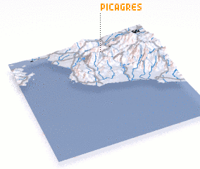 Places with similar names to Picagres, Costa Rica ::
// Pike Acres (US)
// Pokok Keras (MY)
Disclaimer :: Information on this page comes without warranty of any kind |
||
|
Where is Picagres? Elevation and coordinates ::
Latitude (lat): 9°54'0"N Longitude (lon): 84°21'0"W
Elevation (approx.): 600m (map arrows pan, magnifying glasses zoom) |
||
|
Visiting Picagres? Hotel/Accommodation ::
Book a hotel in Picagres Travel Guide ::
Buy a travel guide for Costa Rica rental cars ::
car rental offers GPS waypoint ::
download a GPX waypoint (PoI) of Picagres for your GPS receiver
|
||