|
search place name
|
||
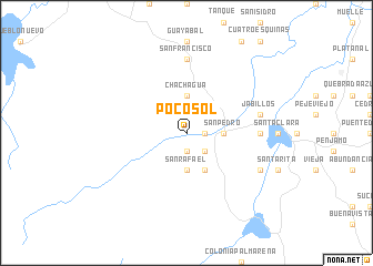
Pocosol (Alajuela, Costa Rica)Pocosol is a town in the Alajuela region of Costa Rica. An overview map of the region around Pocosol is displayed below.
regional and 3d topo map of Pocosol, Costa Rica ::
Pocosol airports ::
The nearest airport is SJO - San Jose Juan Santamaria Intl, located 60.8 km south east of Pocosol.
Other airports nearby include LIR - Liberia Daniel Oduber Quiros Intl (104.6 km west), XQP - Quepos La Managua (115.3 km south east), NOB - Nosara Beach Nosara (121.5 km west), LIO - Limon Intl (180.5 km east), Nearby towns ::
San José (1.9km south) //
San Isidro (1.8km east) //
Tigra (2.6km south east) //
Chachagua (3.7km north) //
San Pedro (3.6km east) //
San Rafael (3.7km south) //
San Gerardo (4.1km south east) //
San Francisco (7.4km north) //
Esperanza (7.3km east) //
Jabillos (7.5km east) //
San Lorenzo (8.2km south east) //
[all distances 'as the bird flies' and approximate] 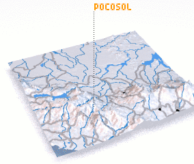 Places with similar names to Pocosol, Costa Rica ::
Disclaimer :: Information on this page comes without warranty of any kind |
||
|
Where is Pocosol? Elevation and coordinates ::
Latitude (lat): 10°22'0"N Longitude (lon): 84°37'0"W
Elevation (approx.): 370m (map arrows pan, magnifying glasses zoom) |
||
|
Visiting Pocosol? Hotel/Accommodation ::
Book a hotel in Pocosol Travel Guide ::
Buy a travel guide for Costa Rica rental cars ::
car rental offers GPS waypoint ::
download a GPX waypoint (PoI) of Pocosol for your GPS receiver
|
||