|
search place name
|
||
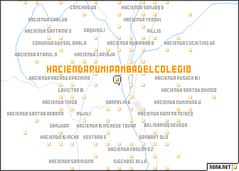
Hacienda Rumipamba del Colegio (Cotopaxi, Ecuador)Hacienda Rumipamba del Colegio is a town in the Cotopaxi region of Ecuador. An overview map of the region around Hacienda Rumipamba del Colegio is displayed below.
regional and 3d topo map of Hacienda Rumipamba del Colegio, Ecuador ::
Hacienda Rumipamba del Colegio airports ::
The nearest airport is ATF - Ambato Chachoan, located 35.1 km south of Hacienda Rumipamba del Colegio.
Other airports nearby include UIO - Quito Mariscal Sucre Intl (85.5 km north), XMS - Macas Coronel E Carvajal (164.9 km south), OCC - Coca Francisco De Orellana (189.5 km east), GYE - Guayaquil Jose Joaquin De Olmedo Intl (196.7 km south west), Nearby towns ::
Hacienda La Calerita (1.9km east) //
Hacienda La Calera (1.9km north) //
Hacienda San Enrique (1.9km north) //
Hacienda Colaiza (2.6km south east) //
Hacienda San Gabriel (2.6km south east) //
Hacienda Laigua de Rivadeneira (2.6km north east) //
Hacienda Laigua de Estupiñán (2.6km north east) //
San Felipe (3.7km south) //
Hacienda Pichil (3.7km south) //
San Buenaventura (3.7km east) //
Once de Noviembre (3.7km west) //
Hacienda Tilipulo (3.7km west) //
Latacunga (4.1km south east) //
Hacienda Laigua del Colegio (4.1km north east) //
Hacienda Inchapo (4.1km south west) //
Hacienda Bellavista (4.1km north east) //
Hacienda Tilipulito (4.1km north west) //
Poaló (4.1km north west) //
Aláquez (5.2km north east) //
Ignacio Flores (5.2km south east) //
Hacienda La Rioja (5.2km north west) //
Hacienda Nintanga Vásconez (5.6km north) //
Hacienda Nintanga Alto (5.6km north) //
Hacienda Nintanga Bajo (5.6km north) //
Hacienda San Felipe (5.9km south) //
Hacienda Rumipamba (5.9km north) //
Hacienda Laigua de Maldonado (5.9km north) //
Hacienda Mulinlibi (5.9km west) //
Hacienda Saraloma (5.9km south) //
[all distances 'as the bird flies' and approximate] 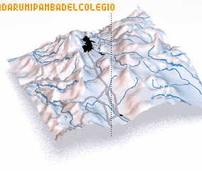 Places with similar names to Hacienda Rumipamba del Colegio, Ecuador :: Disclaimer :: Information on this page comes without warranty of any kind |
||
|
Where is Hacienda Rumipamba del Colegio? Elevation and coordinates ::
Latitude (lat): 0°54'0"S Longitude (lon): 78°38'0"W
Elevation (approx.): 2810m (map arrows pan, magnifying glasses zoom) |
||
|
Visiting Hacienda Rumipamba del Colegio? Hotel/Accommodation ::
Book a hotel in Hacienda Rumipamba del Colegio Travel Guide ::
Buy a travel guide for Ecuador rental cars ::
car rental offers GPS waypoint ::
download a GPX waypoint (PoI) of Hacienda Rumipamba del Colegio for your GPS receiver
|
||