|
search place name
|
||
Hacienda San Agustín (Pichincha, Ecuador)Hacienda San Agustín is a town in the Pichincha region of Ecuador. An overview map of the region around Hacienda San Agustín is displayed below.
regional and 3d topo map of Hacienda San Agustín, Ecuador ::

Hacienda San Agustín airports ::
The nearest airport is UIO - Quito Mariscal Sucre Intl, located 15.4 km west of Hacienda San Agustín.
Other airports nearby include ATF - Ambato Chachoan (121.9 km south), TUA - Tulcan Teniente Coronel Luis A Mantilla (126.4 km north east), IPI - Ipiales San Luis (133.5 km north east), OCC - Coca Francisco De Orellana (156.1 km east), Nearby towns ::
Hacienda La Compañía (1.9km north) //
Hacienda Otón (2.6km north east) //
Hacienda La Merced (2.6km north west) //
Hacienda Nápoles (2.6km south west) //
Hacienda Chaupi (2.6km south west) //
Hacienda La Tola (3.7km east) //
Checa (3.7km east) //
Hacienda Guadalupe (3.7km east) //
Hacienda Guambi (3.7km south) //
Hacienda La Palma (3.7km south) //
Hacienda Uravía (4.1km north east) //
Hacienda Alagache (4.1km south east) //
Hacienda La Victoria (4.1km south east) //
Yaruguí (4.1km south east) //
Hacienda Santa Rosa (4.1km south east) //
Hacienda La Loma (4.1km south west) //
Hacienda San Carlos (5.2km south east) //
Hacienda Albán (5.2km south west) //
Hacienda El Ingenio (5.2km south west) //
Hacienda Puruanta (5.6km north) //
Puembo (5.6km south) //
Hacienda San José (5.6km south) //
Quinche (5.9km east) //
Hacienda La Compañía (5.9km north) //
Hacienda El Pino (5.9km north) //
Tababela (5.9km south) //
Hacienda San José (5.9km east) //
Hacienda Agato (5.9km north) //
Hacienda Chiche Viteri (5.9km south) //
[all distances 'as the bird flies' and approximate] 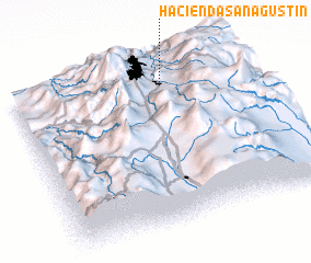 Places with similar names to Hacienda San Agustín, Ecuador ::
// Hacienda San Agustín (EC)
// Hacienda San Agustín (EC)
// Hacienda San Agustín (EC)
// Hacienda San Agustín (EC)
// Hacienda San Agustín (EC)
// Hacienda San Agustín (EC)
// Hacienda San Agustín (EC)
// Hacienda San Agustín (EC)
// Hacienda San Agustín (EC)
// Hacienda San Agustín (PE)
Disclaimer :: Information on this page comes without warranty of any kind |
||
|
Where is Hacienda San Agustín? Elevation and coordinates ::
Latitude (lat): 0°8'0"S Longitude (lon): 78°21'0"W
Elevation (approx.): 2418m (map arrows pan, magnifying glasses zoom) |
||
|
Visiting Hacienda San Agustín? Hotel/Accommodation ::
Book a hotel in Hacienda San Agustín Travel Guide ::
Buy a travel guide for Ecuador rental cars ::
car rental offers GPS waypoint ::
download a GPX waypoint (PoI) of Hacienda San Agustín for your GPS receiver
|
||