|
search place name
|
||
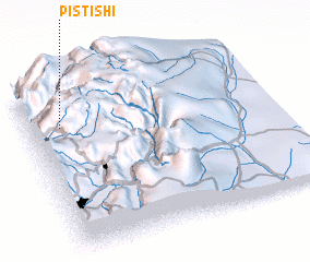
Pistishí (Chimborazo, Ecuador)Pistishí is a town in the Chimborazo region of Ecuador. An overview map of the region around Pistishí is displayed below.
regional and 3d topo map of Pistishí, Ecuador ::

Pistishí airports ::
The nearest airport is CUE - Cuenca Mariscal Lamar, located 73.7 km south of Pistishí.
Other airports nearby include XMS - Macas Coronel E Carvajal (83.3 km east), GYE - Guayaquil Jose Joaquin De Olmedo Intl (113.4 km west), ATF - Ambato Chachoan (117.5 km north), MCH - Machala General Manuel Serrano (167.1 km south west), Nearby towns ::
 Places with similar names to Pistishí, Ecuador ::
Disclaimer :: Information on this page comes without warranty of any kind |
||
|
Where is Pistishí? Elevation and coordinates ::
Latitude (lat): 2°14'0"S Longitude (lon): 78°52'0"W
Elevation (approx.): 2271m (map arrows pan, magnifying glasses zoom) |
||
|
Visiting Pistishí? Hotel/Accommodation ::
Book a hotel in Pistishí Travel Guide ::
Buy a travel guide for Ecuador rental cars ::
car rental offers GPS waypoint ::
download a GPX waypoint (PoI) of Pistishí for your GPS receiver
|
||