|
search place name
|
||
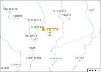
Putunts (Morona-Santiago, Ecuador)Putunts is a town in the Morona-Santiago region of Ecuador. An overview map of the region around Putunts is displayed below.
regional and 3d topo map of Putunts, Ecuador ::
Putunts airports ::
The nearest airport is XMS - Macas Coronel E Carvajal, located 84.5 km north west of Putunts.
Other airports nearby include CUE - Cuenca Mariscal Lamar (176.9 km west), ATF - Ambato Chachoan (199.8 km north west), Nearby towns ::
Pampants (5.4km north west) //
Tambo Chumpi (5.5km north west) //
Jiat (5.6km west) //
Tsentzakentza (7.2km north east) //
Neikimentza (7.4km west) //
Tuutinentza (7.9km north west) //
Putuimi (8.6km south west) //
Tintiukentza (9.0km north) //
Bacundo (9.2km north east) //
Tsuayentza (9.4km north east) //
[all distances 'as the bird flies' and approximate] 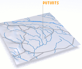 Places with similar names to Putunts, Ecuador ::
Disclaimer :: Information on this page comes without warranty of any kind |
||
|
Where is Putunts? Elevation and coordinates ::
Latitude (lat): 2°35'46"S Longitude (lon): 77°25'14"W
Elevation (approx.): 257m (map arrows pan, magnifying glasses zoom) |
||
|
Visiting Putunts? Hotel/Accommodation ::
Book a hotel in Putunts Travel Guide ::
Buy a travel guide for Ecuador rental cars ::
car rental offers GPS waypoint ::
download a GPX waypoint (PoI) of Putunts for your GPS receiver
|
||