|
search place name
|
||
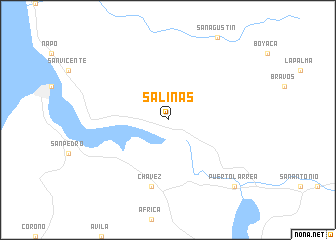
Salinas (Manabí, Ecuador)Salinas is a town in the Manabí region of Ecuador. An overview map of the region around Salinas is displayed below.
regional and 3d topo map of Salinas, Ecuador ::
Salinas airports ::
The nearest airport is PVO - Portoviejo Reales Tamarindos, located 49.0 km south west of Salinas.
Other airports nearby include MEC - Manta Eloy Alfaro Intl (54.5 km south west), GYE - Guayaquil Jose Joaquin De Olmedo Intl (174.8 km south), SNC - Salinas General Ulpiano Paez (189.9 km south west), ATF - Ambato Chachoan (202.4 km east), Nearby towns ::
Chávez (7.6km south) //
Puerto Larrea (10.5km south east) //
[all distances 'as the bird flies' and approximate] 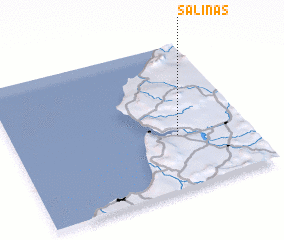 Places with similar names to Salinas, Ecuador ::
Disclaimer :: Information on this page comes without warranty of any kind |
||
|
Where is Salinas? Elevation and coordinates ::
Latitude (lat): 0°38'0"S Longitude (lon): 80°18'0"W
Elevation (approx.): 60m (map arrows pan, magnifying glasses zoom) |
||
|
Visiting Salinas? Hotel/Accommodation ::
Book a hotel in Salinas Travel Guide ::
Buy a travel guide for Ecuador rental cars ::
car rental offers GPS waypoint ::
download a GPX waypoint (PoI) of Salinas for your GPS receiver
|
||