|
search place name
|
||
Santa Isabel (Guayas, Ecuador)Santa Isabel is a town in the Guayas region of Ecuador. An overview map of the region around Santa Isabel is displayed below.
regional and 3d topo map of Santa Isabel, Ecuador ::

Santa Isabel airports ::
The nearest airport is GYE - Guayaquil Jose Joaquin De Olmedo Intl, located 46.1 km west of Santa Isabel.
Other airports nearby include CUE - Cuenca Mariscal Lamar (88.4 km south east), MCH - Machala General Manuel Serrano (122.9 km south west), XMS - Macas Coronel E Carvajal (151.6 km east), ATF - Ambato Chachoan (154.3 km north east), Nearby towns ::
San Carlos (2.6km north east) //
Tomasita (3.7km south) //
La Josefina (5.2km north east) //
Naranjito (5.6km north) //
Hacienda San Ramón (5.9km south) //
Hacienda Payo (5.9km south) //
Hacienda Soledad (5.9km west) //
Hacienda San Carlos (6.7km north west) //
La Lola (7.4km east) //
Hacienda Payo (7.4km west) //
Hacienda Vainilla (7.6km west) //
Hacienda María Teresa (7.9km south west) //
Vainilla (8.3km south west) //
Venecia (8.3km north west) //
Hacienda Virgilia (9.3km south east) //
Coronel Marcelino Maridueña (10.5km north east) //
[all distances 'as the bird flies' and approximate] 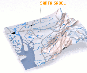 Places with similar names to Santa Isabel, Ecuador ::
// Santa Isabel (BR)
// Santa Isabel (BR)
// Santa Isabel (BR)
// Santa Isabel (BR)
// Santa Isabel (BR)
// Santa Isabel (BR)
// Santa Isabel (BR)
// Santa Isabel (BR)
// Santa Isabel (BR)
// Santa Isabel (BR)
Disclaimer :: Information on this page comes without warranty of any kind |
||
|
Where is Santa Isabel? Elevation and coordinates ::
Latitude (lat): 2°16'0"S Longitude (lon): 79°29'0"W
Elevation (approx.): 25m (map arrows pan, magnifying glasses zoom) |
||
|
Visiting Santa Isabel? Hotel/Accommodation ::
Book a hotel in Santa Isabel Travel Guide ::
Buy a travel guide for Ecuador rental cars ::
car rental offers GPS waypoint ::
download a GPX waypoint (PoI) of Santa Isabel for your GPS receiver
|
||