|
search place name
|
||
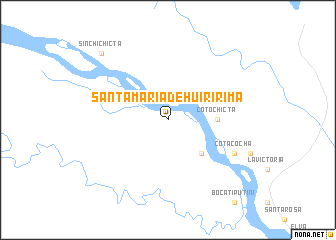
Santa María de Huiririma (Orellana, Ecuador)Santa María de Huiririma is a town in the Orellana region of Ecuador. An overview map of the region around Santa María de Huiririma is displayed below.
regional and 3d topo map of Santa María de Huiririma, Ecuador ::
Santa María de Huiririma airports ::
The nearest airport is TPC - Tarapoa, located 103.7 km north west of Santa María de Huiririma.
Other airports nearby include OCC - Coca Francisco De Orellana (155.1 km west), PUU - Puerto Asis Tres De Mayo (167.2 km north west), Nearby towns ::
Bellavista (5.2km south east) //
Coto Chicta (5.6km east) //
Cotacocha (8.3km south east) //
Sinchi Chicta (10.5km north west) //
[all distances 'as the bird flies' and approximate]  Places with similar names to Santa María de Huiririma, Ecuador :: Disclaimer :: Information on this page comes without warranty of any kind |
||
|
Where is Santa María de Huiririma? Elevation and coordinates ::
Latitude (lat): 0°43'0"S Longitude (lon): 75°37'0"W
Elevation (approx.): 206m (map arrows pan, magnifying glasses zoom) |
||
|
Visiting Santa María de Huiririma? Hotel/Accommodation ::
Book a hotel in Santa María de Huiririma Travel Guide ::
Buy a travel guide for Ecuador rental cars ::
car rental offers GPS waypoint ::
download a GPX waypoint (PoI) of Santa María de Huiririma for your GPS receiver
|
||