|
search place name
|
||
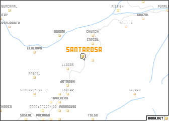
Santa Rosa (Chimborazo, Ecuador)Santa Rosa is a town in the Chimborazo region of Ecuador. An overview map of the region around Santa Rosa is displayed below.
regional and 3d topo map of Santa Rosa, Ecuador ::
Santa Rosa airports ::
The nearest airport is CUE - Cuenca Mariscal Lamar, located 61.8 km south of Santa Rosa.
Other airports nearby include XMS - Macas Coronel E Carvajal (90.5 km east), GYE - Guayaquil Jose Joaquin De Olmedo Intl (107.5 km west), ATF - Ambato Chachoan (130.2 km north), MCH - Machala General Manuel Serrano (154.2 km south west), Nearby towns ::
Compud (1.9km east) //
Capzol (4.1km north east) //
Llagos (4.1km south west) //
Chunchi (5.9km north) //
Joyagshi (6.7km south west) //
Huigra (7.9km north west) //
Chical (8.3km south west) //
Chocar (8.3km south west) //
Angas (9.3km south west) //
[all distances 'as the bird flies' and approximate] 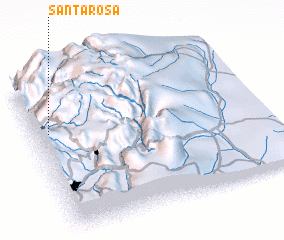 Places with similar names to Santa Rosa, Ecuador ::
// Sania Torres (MA)
// Santa Rosa (BR)
// Santa Rosa (BR)
// Santa Rosa (BR)
// Santa Rosa (BR)
// Santa Rosa (BR)
// Santa Rosa (BR)
// Santa Rosa (BR)
// Santa Rosa (BR)
// Santa Rosa (BR)
Disclaimer :: Information on this page comes without warranty of any kind |
||
|
Where is Santa Rosa? Elevation and coordinates ::
Latitude (lat): 2°20'0"S Longitude (lon): 78°56'0"W
Elevation (approx.): 2722m (map arrows pan, magnifying glasses zoom) |
||
|
Visiting Santa Rosa? Hotel/Accommodation ::
Book a hotel in Santa Rosa Travel Guide ::
Buy a travel guide for Ecuador rental cars ::
car rental offers GPS waypoint ::
download a GPX waypoint (PoI) of Santa Rosa for your GPS receiver
|
||