|
search place name
|
||
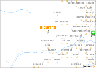
Siguitag (Tungurahua, Ecuador)Siguitag is a town in the Tungurahua region of Ecuador. An overview map of the region around Siguitag is displayed below.
regional and 3d topo map of Siguitag, Ecuador ::
Siguitag airports ::
The nearest airport is ATF - Ambato Chachoan, located 17.7 km east of Siguitag.
Other airports nearby include UIO - Quito Mariscal Sucre Intl (122.0 km north), XMS - Macas Coronel E Carvajal (137.7 km south east), GYE - Guayaquil Jose Joaquin De Olmedo Intl (164.9 km south west), CUE - Cuenca Mariscal Lamar (187.1 km south), Nearby towns ::
San Fernando (3.7km south) //
Pasa (5.6km south) //
Quizapincha (5.9km east) //
Hacienda La Calera (6.7km south east) //
Santo Domingo (6.7km north east) //
Pilahuín (7.6km south) //
Quillalli (8.3km south east) //
Monchuca (8.3km north east) //
Illaguas (8.3km north east) //
Benigno Vela (9.3km south east) //
Santa Rosa (10.5km south east) //
[all distances 'as the bird flies' and approximate]  Places with similar names to Siguitag, Ecuador ::
Disclaimer :: Information on this page comes without warranty of any kind |
||
|
Where is Siguitag? Elevation and coordinates ::
Latitude (lat): 1°13'0"S Longitude (lon): 78°44'0"W
Elevation (approx.): 3503m (map arrows pan, magnifying glasses zoom) |
||
|
Visiting Siguitag? Hotel/Accommodation ::
Book a hotel in Siguitag Travel Guide ::
Buy a travel guide for Ecuador rental cars ::
car rental offers GPS waypoint ::
download a GPX waypoint (PoI) of Siguitag for your GPS receiver
|
||