|
search place name
|
||
Tabacundo (Pichincha, Ecuador)Tabacundo is a town in the Pichincha region of Ecuador. An overview map of the region around Tabacundo is displayed below.
regional and 3d topo map of Tabacundo, Ecuador ::

Tabacundo airports ::
The nearest airport is UIO - Quito Mariscal Sucre Intl, located 38.4 km south west of Tabacundo.
Other airports nearby include TUA - Tulcan Teniente Coronel Luis A Mantilla (100.3 km north east), IPI - Ipiales San Luis (107.3 km north east), ATF - Ambato Chachoan (145.6 km south), OCC - Coca Francisco De Orellana (146.5 km south east), Nearby towns ::
Hacienda Puruanta (1.9km west) //
Hacienda San José (1.9km west) //
San José (2.6km north west) //
Hacienda Santa Gertrudis (2.6km north west) //
Hacienda Cananvalle (2.6km south east) //
Santa Teresita (3.7km west) //
Hacienda Picalquí (3.7km west) //
Hacienda San José Grande (3.7km north) //
Hacienda Alegría (3.7km east) //
Hacienda Granobles (3.7km east) //
Tupigachi (4.1km north east) //
Hacienda La Tola (4.1km north east) //
Hilda (5.2km north east) //
Hacienda Génova (5.2km north east) //
Tapia (5.2km north east) //
Hacienda Vieja (5.6km east) //
Hacienda Changalá (5.6km east) //
Hacienda Huaraquí Chiquito (5.6km west) //
Hacienda Huaraquí Grande (5.6km west) //
La Esperanza (5.6km west) //
Patarata (5.6km east) //
Sigsal Alto (5.6km east) //
Sigsal Bajo (5.6km east) //
Chaupi Loma (5.6km north) //
Hacienda Miraflores Bajo (5.9km east) //
Hacienda Miraflores Alto (5.9km east) //
Juan Montalvo (5.9km east) //
Hacienda Tomalón Grande (5.9km west) //
Pingulmí (5.9km south) //
[all distances 'as the bird flies' and approximate] 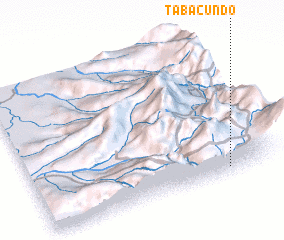 Places with similar names to Tabacundo, Ecuador ::
// Tabougount (MA)
// Tubikǝnd (AZ)
// Debkānda (BD)
// Diabakounda (SN)
// Dab Kandao (PK)
// Tabacunta (HN)
// Dabey Gandi (ML)
// Dabaknet'i (GE)
// Daba Kunda (GM)
// De Beekkant (NL)
Disclaimer :: Information on this page comes without warranty of any kind |
||
|
Where is Tabacundo? Elevation and coordinates ::
Latitude (lat): 0°3'0"S Longitude (lon): 78°12'0"W
Elevation (approx.): 2864m (map arrows pan, magnifying glasses zoom) |
||
|
Visiting Tabacundo? Hotel/Accommodation ::
Book a hotel in Tabacundo Travel Guide ::
Buy a travel guide for Ecuador rental cars ::
car rental offers GPS waypoint ::
download a GPX waypoint (PoI) of Tabacundo for your GPS receiver
|
||